By: T.V. Padma
Send to a friend
The details you provide on this page will not be used to send unsolicited email, and will not be sold to a 3rd party. See privacy policy.
[HYDERABAD] Space technology has enormous potential to help developing countries progress, an international meeting has been told.
Karl Doetsch, chairman of US-based firm Athena Global, told a plenary session of the International Astronautical Congress meeting in Hyderabad, India, on Friday (28 September) that sustained poverty reduction needs the application of space technology and that space scientists should play a larger role in policymaking.
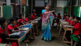
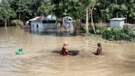
India uses satellite technology to invigorate development by improving communications and the management of natural disasters and resources such as water, and for weather forecasting, long-distance education and telemedicine services. It is a model other countries should follow, Doetsch says.
At the conference, Jason Hay of the US-based Space Policy Institute at the George Washington University pointed out that developing countries are increasingly turning to space technology to speed up their development.
Space technology, he said, can also improve technical skills, infrastructure and knowledge capital, and provide services such as global positioning information.
His team has developed an analytical model of the Indian space experience and applied it to Kazakhstan and South Africa to gain insight into features that could make satellite technology as effective as in India.
Remote-sensing satellite images are useful for monitoring volcanoes, forest fires and earthquakes in Indonesia, says Harijono Djojodihardo, professor at Universitas Al Azhar in Jakarta and former head of Indonesia’s space agency.
It is now the “challenge and responsibility” of space agencies to use their technology for sustainable development of Sub-Saharan Africa, said Simona Di Ciaccio from Italy’s space agency, ASI.
ASI is running a project with Kenya’s Marine and Fisheries Research Institute to use ASI’s remote-sensing satellite for information on fish locations for Kenya’s fishermen, to locate degraded land and to detect oil spills.
Di Ciaccio told SciDev.Net that ASI plans to start two new projects in October this year, setting up a remote-sensing regional centre in Kenya and launching small satellites designed for Kenya’s needs.
Meanwhile, the University of Stellenbosch in South Africa is working on the design of a small satellite equipped with high- and medium-resolution cameras to monitor equatorial forests that are hard to visualise because of widespread cloud cover.
This kind of assessment is important due to the impact of climate change on equatorial forests, said Stellenbosh scientist Keijo Nissen.

