13/04/15
Insights from satellites boost off-grid power supply
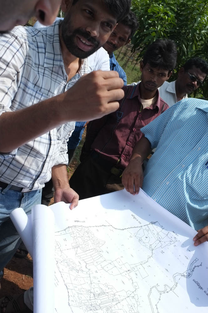
Members of the GridForm team in the field. Rural development involves understanding the unique terrain and buildings in each area, and maps are a crucial part of the process. While data collected on the ground is still important, the use of increasingly accurate satellite imagery is helping the mapping process
MIT
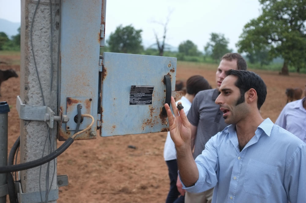
Thee team examines the energy infrastructure of an Indian village. Analysing the existing electricity infrastructure helps when designing more-efficient local electricity grids, known as microgrids
MIT
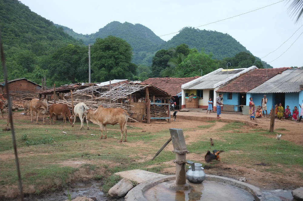
A village in Odisha, India. In India, approximately 300 million people lack electricity. Connecting their households to a microgrid, which provides reliable energy, could help lift many of them out of poverty
MIT
Power lines connecting the main electricity grid to rural settlements. This method is not cost effective as significant amounts of energy are lost during transmission
MIT
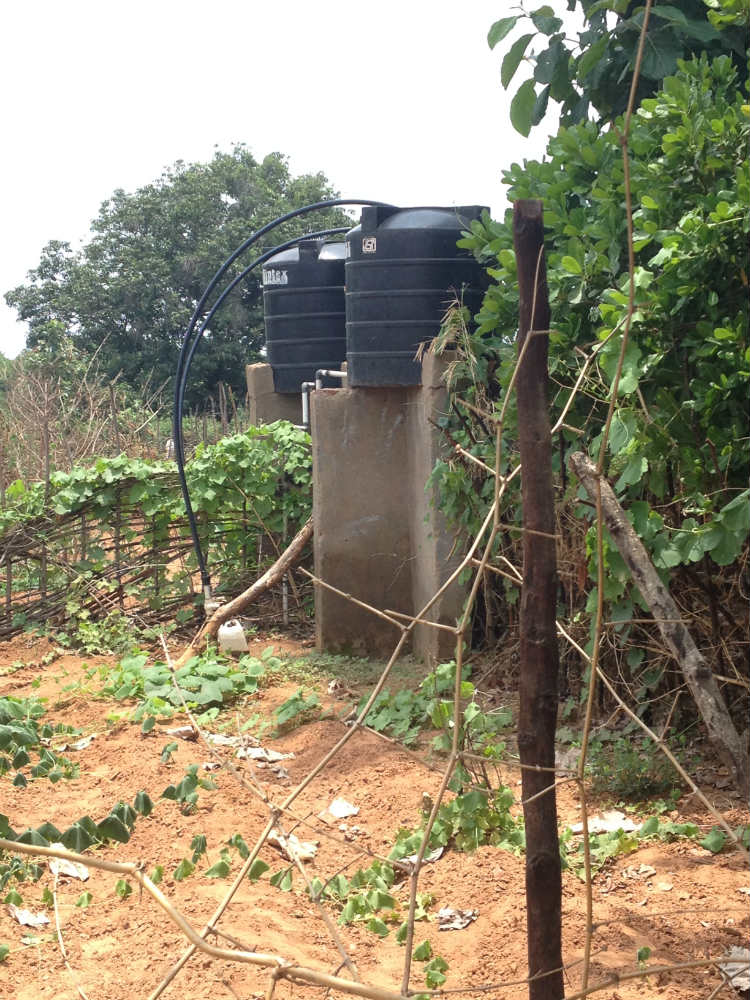
Access to electricity boosts agricultural productivity by powering essential equipment such as water pumps
MIT
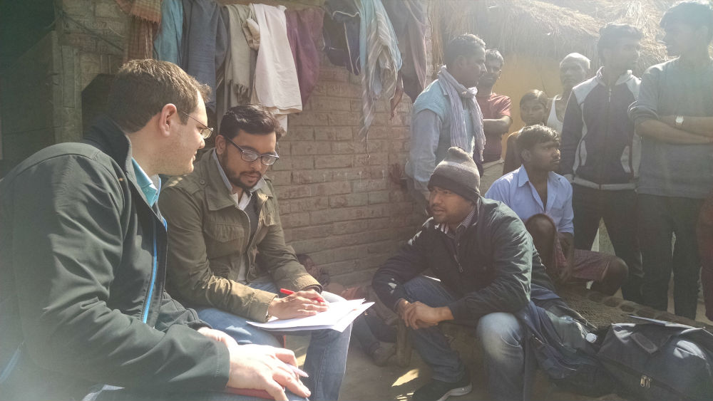
Local partners share practical insights with the researchers. The contribution of local organisations and individuals is important to validate satellite data. This supports the development of the algorithm that automatically reads satellite imagery and provides accurate information on the layout of each settlement
MIT
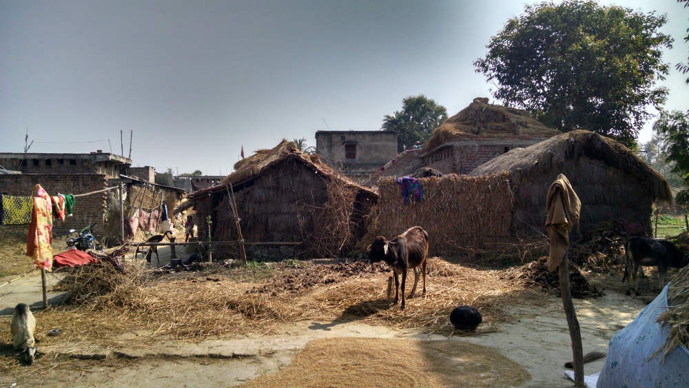
A village in Bihar, India. The different building materials and unique layout of each village require thorough study that, until now, had to be done in the field. The new technology aims to automate part of the process, making it quicker and cheaper
MIT
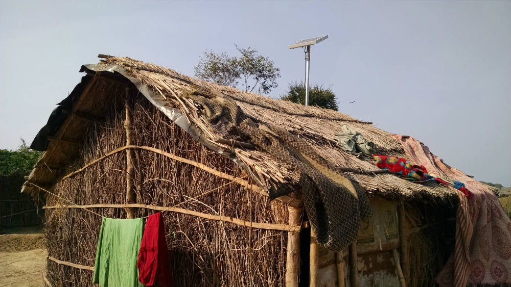
Single-home solar lighting systems such as this provide enough power to light homes at night and charge mobile phones
MIT
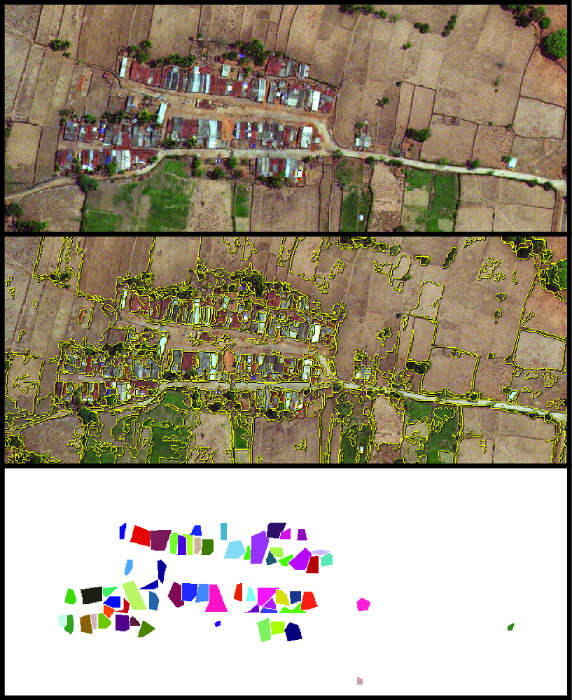
The software developed by the GridForm team can identify houses from satellite imagery. It learns by being exposed to new data, without being explicitly reprogrammed, in a process known as machine learning
MIT
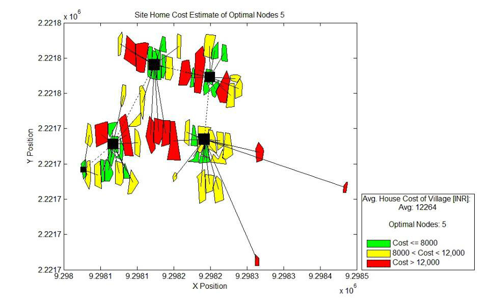
The GridForm produces a map of the main elements in a settlement, which look like nodes in a grid configuration. The nodes refer to energy generation points, in this case solar panels. The colours indicate the estimated cost of the system for each household
MIT
By: Lou Del Bello
Send to a friend
The details you provide on this page will not be used to send unsolicited email, and will not be sold to a 3rd party. See privacy policy.
When planning rural development, understanding the unique spatial and social features of each settlement is essential. To bring local power systems to villages, engineers must map the area and then figure out the best configuration for the different elements.
A team of data scientists and graduate students at the Massachusetts Institute of Technology in the United States has developed computer software that automatically interprets satellite imagery, identifying different types of buildings and making it easier for rural planners to design ‘microgrids’ suited to the local context.
These pictures illustrate the first stages of the GridForm project, where researchers travelled to rural India to inspect off-grid settlements and, working with local people, collected data to improve their software.
More on Engineering