By: Bhrikuti Rai
Send to a friend
The details you provide on this page will not be used to send unsolicited email, and will not be sold to a 3rd party. See privacy policy.
[KATHMANDU] The snowstorm that killed 39 people on one of Nepal’s popular trekking routes, the Annapurna Circuit, in October, highlights the urgent need for better early-warning weather systems in the Himalayas as well as Nepal’s poor state of data sharing.
Tourism is a major contributor to Nepal's economy, providing employment to more than 750,000 people in a country with an unemployment rate of more than 45 per cent.
Every year, thousands of foreign tourists take to the trails of the Himalayas. And when the lethal blizzard hit the Annapurna circuit on 14 October, many became trapped in the sudden snowstorm.
“There isn’t a formal channel in Nepal to provide an official and dependable early warning to people in the mountains even on popular trekking routes.”
Lhakpa Rhitar Sherpa
The blizzard was caused by the remnants of Cyclone Hudhud as it veered north towards Nepal after making landfall on 12 October in India.
Most of the casualties were among those caught on Thorong La pass at 5,400 metres, the highest point of the circuit.
“We had informed the home ministry, which is in charge of emergency operations, about the approaching weather, but they fell short on conveying the message to those who perished,” says Suman Regmi, senior meteorologist at the Meteorological Forecasting Division of Nepal’s Department of Hydrology and Meteorology. “We don’t have any mechanism in place to disseminate the information to the local level, which resulted in such a large loss of life in the Annapurna region.”
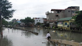
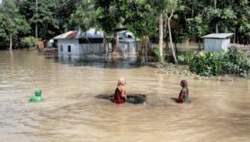
This is the latest in a number of tragedies to hit the Himalayas in recent years due to severe weather conditions. In 1995, 24 trekkers and guides died during a blizzard on the Gokyo trail. Last year, heavy rainfall caused flooding that killed more than 1,000 in Uttrakhand in northern India and unleashed havoc in western Nepal, sweeping away 77 buildings and displacing 2,500 people in the town of Darchula.
The regional hub of the UN’s World Meteorological Organization in New Delhi, India, shares data with Nepal’s Department of Hydrology and Meteorology every three hours. But while the department received the warning in October about the impending snowstorm in good time, there was a delay in relaying it to the communities higher up in the Annapurna region, hindering the disaster response, say trekking guides.
Lhakpa Rhitar Sherpa, a guide with more than 20 years’ experience, was among those who narrowly escaped the blizzard near Thorong La pass. “The weather was clear the day before and since phone line and internet connection is patchy there, we went ahead with our trek on 14 October without checking the forecast,” says Sherpa.
Early in the morning, when the team of five tourists and four porters he was leading set out, the snow was barely knee deep. “By the time we reached Thorong La pass, the blizzard had become fierce and the snow was more than four feet deep,” says Sherpa. “We passed a tourist who broke his leg in the snowstorm and was waiting to be rescued.”
Like many trekkers, Sherpa says he would have changed his plans had he been told about the snowstorm. “We wouldn’t have moved ahead had we known how intense the storm would be. But there isn’t a formal channel in Nepal to provide an official and dependable early warning to people in the mountains even on popular trekking routes,” he says.
Although Nepal and its two neighbours, China and India, share weather satellite imagery, some experts partly blame insufficient regional sharing of information about severe weather for the ongoing loss of life and property.
“Since climate change is making weather more unpredictable, countries in the region need to work together to have multi-disaster preparedness systems in place,” says Rajendra Sharma, chief of flood forecasting at Nepal’s Department of Hydrology and Meteorology.
At the SAARC (South Asian Association for Regional Cooperation) summit in Kathmandu on 26 and 27 November, participants agreed the Kathmandu Declaration that welcomed the decision to establish a management centre to implement the association’s agreement on rapid response to natural disasters.
In addition, intergovernmental research organisation ICIMOD (International Centre for Integrated Mountain Development) has been working with the World Meteorological Organization and regional partners on a long-term project to establish a regional flood warning system in the eight countries comprising the Hindu Kush Himalayan region.
“We need to focus on end-to-end systems where data and information about extreme events in weather and river conditions are analysed and disseminated [in a timely way] to the various levels of users down to the communities where the response on preparedness is taken,” says Mandira Shrestha, a water expert at ICIMOD.
A weather forecast was available for the Annapurna region back in October, she says. If only an appropriate mechanism had been in place to warn the trekkers and their guides, the blizzard’s impact could have been minimised, she adds.
> Link to the Kathmandu Declaration
More on Disasters