
Send to a friend
The details you provide on this page will not be used to send unsolicited email, and will not be sold to a 3rd party. See privacy policy.
[BUENOS AIRES] In August 2007, a magnitude 8.0 earthquake struck the Peruvian coast, killing 519 people and destroying more than 58,000 houses. Then, recovery was based on what could be seen from the ground.
About a decade later, in early 2017, dozens of people were killed in El Niño flooding, but the circumstances were somewhat different.
By that time, remote images from planes, drones and satellites were available. PeruSat 1, the first national terrestrial observation satellite, launched in December 2016.
“We track places where the temperature rises to dangerous levels. We aim to develop a system to tell the population when some places are more risky than usual.”
Víctor Magaña, researcher, National Laboratory of Earth Observation, Mexico
“Although we were in a better situation, we had an additional problem,” remembers José Pasapera, technical director of space sciences and applications at Peru’s National Commission for Aerospace Research and Development (CONIDA). “We had the hardware but not processing capabilities; there were not human resources available nor a procedure guide.”
Satellites are increasingly being used to monitor and manage floods, earthquakes, fires and even volcanic eruptions, and capacity is being ramped up to use the technology to its full advantage.
And satellite development is contributing to cooperation not only among countries in the region, but also with regions with more developed capabilities, such as China, the European Union and the United States.
Space-based cooperation
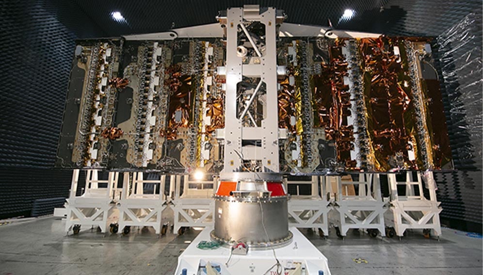
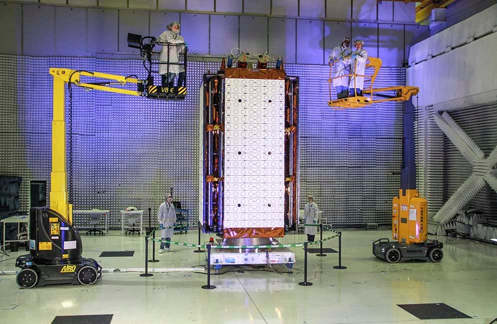
Argentina is set to launch SAOCOM 1B (Argentine Microwaves Observation Satellite) to complete the ‘constellation’ of two Earth observation satellites designed and made in the country. The first, SAOCOM 1A, has been in polar orbit since 2016. The launch was scheduled for March 30 in the United States, but has been delayed due to coronavirus travel restrictions.
Laura Frulla, Earth observation manager and principal researcher at SAOCOM, said the addition of the second satellite would complete the Italian-Argentinean system for emergencies (SIASGE). “The two SAOCOMs will join four Cosmo SkyMed satellites developed by the Italian Space Agency to get the big picture,” she tells SciDev.Net.
The six satellites working together can perform seismic hazard analysis, disaster monitoring and agricultural mapping.
“Specifically, our mission was requested to detect minimum variations in the humidity of the soil, so agricultural producers have data for decision-making as well as hydrological emergencies,” Frulla said.
Data from SAOCOM images are being sent to the National Water Institute to detect how rain affects rivers. Combined with other data, it predicts the chances of flooding. “Our data is not definitive but another layer of information to take into account,” Frulla adds. The humidity maps have validation networks in the field, with 100 sensors in five key agricultural provinces.
Harnessing the power of data
For countries without their own satellite development, they can access images generated by other countries. This is the case in Colombia, as Carlos Andrés Franco Prieto, coordinator of a research and innovation group in Geographic Institute Agustín Codazzi, explains to SciDev.Net: “We use European Space Agency images, with a 10-metre resolution,” he says.
“It is not optimum and can take a picture in the same place only every six days, but they are free for us. Obviously, when a disaster is happening, not having a constant flow of [images] is a real problem.”
He says Colombia is considering launching its own satellite. “The cost-benefit is good, now it is not as expensive as it used to be. Many countries like Colombia in terms of GDP already have it, so we can join that club,” Prieto says.
And Mexico’s Earth observations system is powered mostly by United States-owned satellites, such as National Oceanic and Atmospheric Administration (NOAA) and the space agency NASA.
The images are received by the National Laboratory of Earth Observation (LANOT, founded in 2018 at the National Autonomous University of Mexico) and are focused on weather phenomena, floods, volcanoes, and forest fires, of which there are thousands each year.
“The civil protection agencies have access to the images in order to monitor disasters in progress and the National Weather Service for foreseeing heavy rains or droughts,” Víctor Magaña, a LANOT researcher tells SciDev.Net.
Pioneering space tech
One area in which Mexico is a pioneer, with technology currently in testing mode, is the monitoring of heat islands in Mexico City.
“We track places where the temperature rises to dangerous levels. We aim to develop a system to tell the population when some places are more risky than usual,” Magaña says.
Researchers want to avoid the thousands of cases of diarrhoea that develop as temperatures increase, as well as heat-related deaths.
Perhaps the biggest regional satellite player is Brazil, which has decades of Earth observation systems experience. Besides monitoring fires and weather, the National Institute for Space Research (INPE) has data on solar radiation, drought, forests and climate change.
Brazil set out its ambitions in 1988 when it joined the China-Brazil Earth Resources Satellite programme (CBERS). Since then, six satellites have been launched, with the most recent in December.The newest development for Brazil will be Amazonia 1, a remote sensing satellite that will take images of the Earth every five days. It is the first entirely developed in Brazil.
In emergency circumstances, a specific geographical point can be assessed in three days, Adenilson Silva, satellite programme coordinator at INPE’s Multi Mission Platform, tells SciDev.Net.
Amazonia 1 is slated to be launched later this year.