Send to a friend
The details you provide on this page will not be used to send unsolicited email, and will not be sold to a 3rd party. See privacy policy.
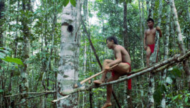
[BONN, GERMANY] The lack of location-specific scientific data on the degradation of land, and the dearth of networks through which to share such data where it does exist, are hampering the fight against desertification, a conference has heard.
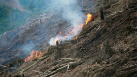
The absence of such data means that the global models that map land degradation and are used in policy and funding decisions misrepresent the situation in many regions, particularly in developing countries, heard the UN Convention to Combat Desertification's (UNCCD) 2nd Scientific Conference in Bonn this week (9-12 April).
Klaus Kellner, South Africa's science and technology correspondent to the UNCCD, tells SciDev.Net that the World Atlas of Desertification, as well as similar maps for climate change and biodiversity, understate the severity of the situation as a result.
SPEED READ
- A lack of data means that global land degradation maps may misrepresent the problem
- Where data exists it can also be inaccessible to policymakers
- But global maps, though deficient, still help in developing solutions
For example, a model presented to the conference indicated only minimal land degradation in the Sahel — a claim contradicted by scientists from the African region who attended the event, he says.
"These global maps often overlook areas that have a lack of data, which are often the poorest and most in need," he adds.
The effect of land degradation, especially in the developing world, is significant, according to a UNCCD report, presented at the conference.
Africa's agricultural GDP is reduced by four to 12 per cent because of environmental damage, the vast majority of which is due to land degradation, the study estimates.
In Guatemala, this figure rises to 24 per cent, it adds.
Yet despite these impacts, inaccurate mapping can lead policymakers to underestimate some areas' vulnerability to land degradation, says Kellner.
While this underrepresentation can be due to a dearth of data on such things as soil quality, plant cover and land use, or a lack of capacity to collect this information, often data exists but is inaccessible, he adds.
For example, Morocco, Senegal and intergovernmental organisation the Sahara and Sahel Observatory have "huge" data sets, he adds. But these are not used, he adds.
Kellner believes that inadequate networks between scientists and institutions, as well as a lack of commitment by these institutions to incorporate data in their models, are to blame for this underutilisation.
Michael Cherlet, a senior researcher at the Joint Research Centre of the European Commission — the body responsible for the World Atlas of Desertification — broadly agrees on both counts.
The centre did indeed overlook local data when developing its atlas, but this was more down to resource limitations than preference, he says.
Nonetheless, even if modellers had wanted access to data, the networks necessary to provide it were inadequate, he adds.
Cherlet says that two possible remedies are for the UNCCD to act as a channel through which countries can pass their data or as an open-access digital repository.
"What I dream of is to have an online platform where people can upload data linked to a model that can be applied on specific scales," he says.
But Cherlet defends global mapping projects, even those based on incomplete data, saying that they are a vital way for international institutions, politicians and other stakeholders to develop wide-scale solutions.
They also allow links to be made with other global data sets, such as for climate change and biodiversity, he adds.
More on Biodiversity