By: Justin Petrone
Send to a friend
The details you provide on this page will not be used to send unsolicited email, and will not be sold to a 3rd party. See privacy policy.
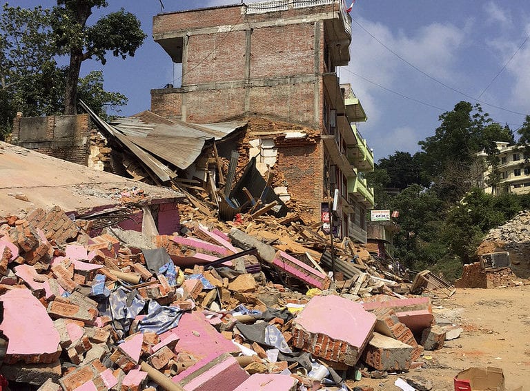
[KATHMANDU] A new study of the 2015 earthquake that shook Nepal, killing roughly 9,000 people, shows that this Himalayan country may have been spared greater destruction due to a lack of surface ruptures as well as the prevalence of high-grade metamorphic and intrusive igneous rocks.
Using satellite images of the disaster zone, a team of scientists mapped 4,312 landslides that occurred both during the quake and its aftermath between 25 April and 10 June. Based on the data, scientists were able to evaluate the geomorphic, tectonic, and lithologic controls on earthquake-induced landslides during the period, especially in areas where the landslides affected local populations.
The scientists described their study in Science, last month (January). According to lead author Jeff Kargel, the effects of the earthquake could have been “far worse,” when seen against analysis and comparisons of similar magnitude earthquakes.
Kargel, a senior associate research scientist in the department of hydrology and water resources at the University of Arizona, also says that the fact that the earthquake could have been more devastating might encourage the Nepalese to make the use of existing data to prepare for future quakes.
“It may alert officials in Nepal and aid and development agencies and corporations in Nepal and around the world that Nepal needs to attend to improved construction and improved land use zoning and improved adherence to land use zoning and building codes,” said Kargel. “To say so is not to criticise the responsible officials,” he cautions. “It’s just a wake-up call to all of us that things could have been worse and potential in the future might be worse if due care and action is not taken.”
Kargel began working on the study as soon as he heard reports of the earthquake on 25 April. Networking with glaciologists in the ‘Global Land Ice Measurements from Space’ project, which he directed at the time, Kargel and his team worked to detect and map the landslides using satellite imagery. They also provided information to relief and recovery officials as the emergency operations were occurring, he said.According to the paper, the distribution of landslides was positively associated with slope and shaking intensity, and the landslides were heavily concentrated where the peak-ground acceleration was greater than 0.6g (acceleration due to Earth's gravity, equivalent to g-force) and the slope greater than 30 degrees.
The scientists noted that in some of the most concentrated destruction and losses of life, outside the earthquake’s centre in the Kathmandu Valley, occurred in the remote north-eastern Langtang Valley directly due to earthquake-induced landslides and air blasts.
Wolfgang Schwanghart, a professor at the University of Potsdam’s Institute of Earth and Environmental Science, said the results “quantitatively underpin previous knowledge on earthquake-induced land sliding in the geologic, tectonic and seismologic context of the Nepal Himalayas, thus providing the data desperately needed for natural hazard and risk assessment.”
Schwanghart added, however, that the study may have missed some of the post seismic landslide activity, due in part to the onset of the monsoon season in the Nepal Himalayas, as the cloud cover would have made additional satellite imaging difficult, and the rains could have induced additional geo-hazards.
“I expect the degree to which the earthquake affected landslide activity is not entirely captured by [the] data,” said Schwanghart, adding that the full dimension of landslide-affected areas may not even now be clear. “Studies in other mountain belts show that landslide activity remains high for many years following a major earthquake,” he said.
This article has been produced by SciDev.Net's South Asia desk.


