By: Bhrikuti Rai
Send to a friend
The details you provide on this page will not be used to send unsolicited email, and will not be sold to a 3rd party. See privacy policy.
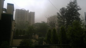
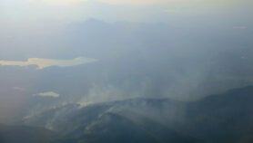
[KATHMANDU] The 7.8 magnitude earthquake that struck Nepal on 25 April and the aftershocks that followed, including one measuring 7.3 may have left the Himalayan country even more vulnerable to monsoon-triggered landslides than before, says a new study.
Published on 28 July in the US Geological Survey (USGS) Open File Report, the study, which considers existing and potential landslides, says that the increased vulnerability could last several years.
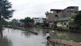
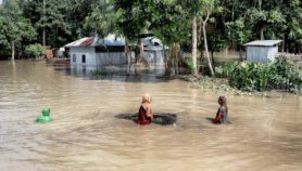
With the onset of this year’s monsoons Nepal has already witnessed several landslides. According to a Nepal government report presented in parliament on 2 August, 35 people were killed by a landslide a week earlier in western Nepal and more than 40 people died lives in a similar event in June in Taplejung in eastern Nepal.
“Rainfall on already destabilised slopes can, in some cases, lead to landslides that might not have occurred with rainfall alone,” says Brian Collins, research civil engineer at USGS and co-author of the study. “In addition, some landslides have blocked river valleys which can pose additional hazards when rivers rise during the monsoon.”
“However, landslides are typical during nearly every monsoon season in Nepal, and so it is hard to judge whether or not these landslides are directly related to earthquake-induced weakening and progressive failure,” Collins tells SciDev.Net.
The quakes triggered thousands of landslides as well as incipient landslide movements. When such masses become saturated with water during monsoon rains they have the potential to move either as intact blocks or to disaggregate and mobilise as a debris flow, which can travel farther and faster than other types of landslides, the report says.
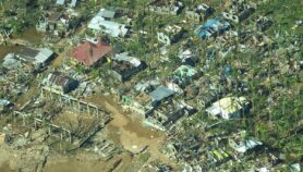
Landslides triggered by the earthquake have already caused significant damage to roads and infrastructure, besides loss of lives. The largest and most destructive event was a debris avalanche that destroyed the village of Langtang, Rasuwa district, which killed more than 200 people.
In preparing the report the USGS collaborated with an international group of remote-sensing scientists, including some from the Kathmandu-based International Centre for Integrated Mountain Development (ICIMOD), to identify areas of Nepal that indicated particularly high levels of landslide hazard in the first few weeks following the earthquake after which USGS also conducted in-country landslide hazard assessment.
“Early warning in risk hotspots is important to minimise loss of lives, a good combination of technology-based and community-based measures would result in a most effective warning system but this requires significant resources,” says Arun Bhakta Shrestha, senior scientist at ICIMOD.
The authors of the USGS study say that although they investigated a large portion of the earthquake affected area, they weren’t able to investigate the entire region (large areas of Nepal and also areas in China) affected by landslides triggered by earthquake.
“We could not make assessments of all potentially-hazardous landslides that we documented — there are simply too many to investigate in a rapid-response mode of hazard assessment,” said Collins.
>Link to full paper in USGS Open File Report
This article has been produced by SciDev.Net's South Asia desk.
References
Collins, B.D., and Jibson, R.W., 2015, Assessment of Existing and Potential Landslide Hazards Resulting from the April 25, 2015 Gorkha, Nepal Earthquake Sequence: U.S. Geological Survey Open-File Report 2015–1142, 50 p.
More on Disasters