By: Amantha Perera
Send to a friend
The details you provide on this page will not be used to send unsolicited email, and will not be sold to a 3rd party. See privacy policy.
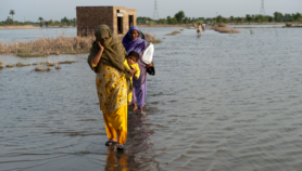
Sri Lankan meteorological experts are relying on forecasts by international agencies that speak of rains in the latter half of May followed by above average monsoons to bring relief from months of scorching temperatures.
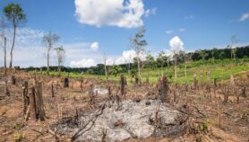
According to the Sri Lankan meteorological department, temperatures have been 2— 5 degrees Celsius above average over the last two months while rainfall has been below normal for the current year so far. A similar situation has prevailed over southern India.
“It has been unusually warm and intermittent rains have not been able to bring much respite,” Lal Chandrapala, chief of the meteorological department, tells SciDev.Net.
High temperatures and lack of rain have prompted President Maithripala Sirisena to appeal to paddy farmers to adjust traditional cultivating time-tables. Similar condition in 2014 caused Sri Lanka to lose 17 per cent of its annual rice output.
Chandrapala says that Sri Lanka has been looking closely at predictions by international bodies, such as the South Asia Climate Forum (SACF), for clues as to how much damage the droughts and high temperatures will wreak on agriculture.
The SACF said in a consensus statement late April that “the strong El Niño conditions that prevailed over the Pacific since July 2015 have now weakened to moderate level. “There was strong consensus that El Niño conditions will continue to weaken and reach a neutral level by the middle of the south-west monsoon.” The June—September south-west monsoon brings 70 per cent of the sub-continent’s rainfall.The consensus emerged from a forum — the eighth such pre-monsoon meeting — held in Colombo (25—26 April) and attended by representatives from Bangladesh, Bhutan, India, Maldives, Myanmar, Nepal, Pakistan, Sri Lanka and experts from the World Meteorological Organisation, the China Meteorological Administration and Japan Meteorological Agency.
Additionally, the European Centre for Medium-Range Weather Forecasts says that by 19 May, a low-pressure area or trough would be moving towards Sri Lanka and up the western coast of India. The Indian Institute of Tropical Meteorology, Pune, also points to a low-pressure ‘trough’ forming over the South Arabian Sea likely to bring rains to the area.
According to the US Climate Prediction Centre, a Madden-Julian Oscillation (MJO) wave over the South Arabian Sea will see rainfall intensifying over Sri Lanka and surrounding areas of southern India by 17 May. Moving eastwards high up in the atmosphere, MJO waves strongly influence cloud formation, storms and rainfall around troughs.
“Weather patterns are changing and it is in our best interest that we have at least some idea of how the monsoon is likely to be. It makes planning easier,” says Chandrapala.
This piece was produced by SciDev.Net’s South Asia desk.
More on Climate change