
By: Fatima Arkin
Send to a friend
The details you provide on this page will not be used to send unsolicited email, and will not be sold to a 3rd party. See privacy policy.
[MANILA] Asia Pacific countries are leveraging geospatial information, digital solutions and artificial intelligence to enhance their response to the ongoing COVID-19 pandemic and to help meet the Sustainable Development Goals (SDGs), according to a new report.
“Data is now a strategic asset,” Tiziana Bonapace, director of the ICT and disaster risk reduction division of UN Economic and Social Commission for Asia and the Pacific (UNESCAP), tells SciDev.Net. “With more use, more value is added.”
“Data is now a strategic asset”
Tiziana Bonapace, UN Economic and Social Commission for Asia and the Pacific (UNESCAP)
The report, which is the first in a series of UNESCAP publications to assess progress towards implementing the Asia-Pacific Plan of Action on Space Applications for Sustainable Development (2018–2030), highlights a number of initiatives throughout the region.
Thailand, for instance, used space applications to monitor the local COVID-19 situation and visualise the impact of development policies. The Geo-Informatics and Space Technology Development Agency analysed reduced night-light images to monitor the impact of lockdown measures. It also used satellite data to monitor nitrogen dioxide emissions and found that since the beginning of the year, most provinces in Thailand had fewer activities that caused emissions. All this data was integrated into a newly created dashboard that allows policymakers and others to monitor the pandemic, medical capacity, supplies, consumer goods and preventive and precautionary measures.
Last March, the Philippines’ Department of Science and Technology – Philippine Council for Industry, Energy and Emerging Technology Research and Development (DOST-PCIEERD) solicited proposals for projects that use geospatial information in response to COVID-19.
One of the proposals was from the University of the Philippines Diliman for an online geographic system to track information on medical resources in local health facilities. Dubbed ‘Tracking for Allocation of Medical Supplies’, the system uses volunteered and crowdsourced data to provide necessary support to ensure proper allocation of medical resources.
Now that the world is on the threshold of vaccine availability, the need for artificial intelligence geospatial information persists as countries plan for a shift towards a “new normal,” Enrico Paringit, executive director of DOST-PCIEERD, tells SciDev.Net.
“This could mean the need to develop tools to ensure safety of public transport systems and offices as the economy is gradually being opened for business. We also need to develop intelligent systems to monitor places of commerce — systems that detect and report compliance to social distancing rules,” he adds.

Yet, despite notable advances, significant challenges remain that prevent Asia Pacific countries from taking full advantage of digital solutions in their COVID-19 responses.
Bonapace highlights major issues: persistent and significant capacity gaps and limitations regarding the technology applications and a lack of guidelines and tools for integrating geospatial, statistical and other kinds of data and information.
For Paringit, openness of data and sustainability are the two main challenges he sees in scaling up digital solutions. “There are concerns over sustainability of platforms developed during the pandemic since it might die down after the initial requirements and needs have been met and the business case had not been thought out in the beginning,” he adds.
The report calls for key factors to integrate geospatial information applications into each country’s planning and actions towards achieving the SDGs. But Bonapace highlights two factors in particular. One is investing in cultivating national experts and the other is encouraging local and international collaborations.
“Given the breadth of thematic and sectoral areas where geospatial information and space applications can add value, there is a need for engagement across a broader set of ministries and responsible authorities beyond the traditional space applications sector, and even beyond borders,” she says. “Partnerships are necessary to combine available data and expertise and maximise results.”
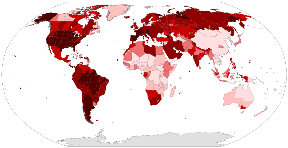
Map of confirmed number of COVID-19 cases per capita as of 29 November 2020.
Image credit: Raphaël Dunant, Gajmar (CC BY 4.0).
Bonapace says that space and geospatial information applications will continue to play an important role in countries’ COVID-19 response. “Hotspot mapping, contact tracing and early warning systems are all capable of strengthening the preparedness for COVID-19 as well as other disasters. These applications can also help in the recovery phase to build back better,” she adds.
This piece was produced by SciDev.Net’s Asia & Pacific desk.