By: Sam Otieno and Gilbert Nakweya
Send to a friend
The details you provide on this page will not be used to send unsolicited email, and will not be sold to a 3rd party. See privacy policy.
[NAIROBI] African countries need to adopt space technologies to monitor the Sustainable Development Goal (SDGs) that impact land, a meeting has heard.
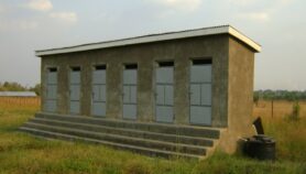
Land is central to the SGDs such as no poverty, zero hunger, sustainable cities and communities and life on land.
Space technologies including global positioning system, geographical information system and remote sensing can be used to generate data on land resources to aid decision-making, according to experts who attended the 2nd Regional Centre for Mapping of Resources for Development conference held in Kenya last month (15-17 August).
However, at the moment, space technology is mainly being used by developed nations to monitor land usage.
“Space technology will enhance analysis and use of earth observation data and geospatial information, which will transform the livelihoods of people.”
Farida Karoney, Ministry of Lands and Physical Planning
“Space technology will enhance analysis and use of earth observation data and geospatial information, which will transform the livelihoods of people on the continent,” Farida Karoney, Kenya’s cabinet secretary of lands and physical planning, told the meeting.
Karoney said there was a need to monitor land ownership and uses to help make decisions that can improve productivity, especially in agriculture to address food and nutrition challenges the continent faces such as hunger and food insecurity.
“We need to modernise the way we manage land,” said Karoney, while challenging scientists to work closely with policy makers to help close the gap between science and policy in theory and in practice.
Patrick Wilson, deputy mission director for USAID Kenya and East Africa, explained that deploying technologies such as global positioning systems, remote sensing and geographic information system can help developing countries to better address critical development issues by providing accurate data.
“Policymakers could make use of the data to find ways of managing environmental risks such as flooding, droughts and make informed decisions that improve livelihoods especially in the arid and semi-arid areas of East Africa region which are the most vulnerable to climate shocks and human conflicts,” Wilson said.
Emmanuel Nkurunziza, director-general of the Regional Centre for Mapping of Resources for Development, told SciDev.Net his outfit is working with member states in applying space science technologies such as satellites to help smallholder farmers determine the potential of their land resources for crop production.Nkurunziza adds the centre is facilitating the use of technologies such as geographic information system to improve environmental management and climate change resilience in member countries such as Burundi, Ethiopia, Kenya, Lesotho, Malawi, Namibia, Rwanda, Zambia and Zimbabwe.
This piece was produced by SciDev.Net’s Sub-Saharan Africa English desk.
More on SDGs