By: Adole Abutu
Send to a friend
The details you provide on this page will not be used to send unsolicited email, and will not be sold to a 3rd party. See privacy policy.
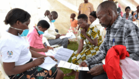
[ABUJA] Maps created with geographic information system (GIS) technology are helping caregivers track people with the deadly Ebola virus in West Africa, according to experts.
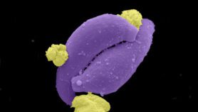
The WHO says as at last week (22 August) the disease had killed 1,427 people in Guinea, Liberia, Nigeria and Sierra Leone.
“The mapping … help organisations on the ground to make decisions so that they will be best able to provide treatment and target communities for education[al] campaigns”.
Dale Kunce,American Red Cross
Dale Kunce, a senior geospatial engineer of the American Red Cross, says the mapping exercise would significantly impact on the ability of humanitarian workers to provide life-saving assistance on the ground and help contain the outbreak of the disease.
Kunce tells SciDev.Net: “The mapping … help organisations on the ground to make decisions so that they will be best able to provide treatment and target communities for education[al] campaigns”.
The continuing project which is being undertaken by the Humanitarian OpenStreetMap Team (HOT) began in March this year at the request of Médecins Sans Frontières and the Red Cross, Kunce notes.
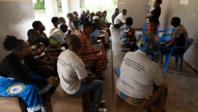
The mapping is addressing one of the challenges facing caregivers in tracking the disease, he adds. “Many small communities often have the same name, which causes confusion for deployed aid workers who are not familiar with the area.
“The mapping project would ensure that when aid workers are called to assist in a community, they know exactly which [place] to go to.”
HOT have been using volunteers who survey with global positioning system (GPS), take digital aerial images of locations and collect existing geographic data to help create open maps, according to information on its website.
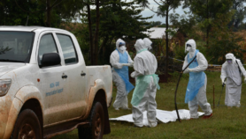
Kunce adds that the maps could be useful in rural areas where GPS and road signs are rare.
Haruna Ayuba, a professor of environmental science at the University of Maiduguri in Nigeria, says the initiative would fast-track efforts to provide medical care to those affected by the virus as well as equip others with necessary information on the spread of the disease.
“The GIS map is an invaluable tool to show endemic areas affected by the virus. Once known, concentrated attention can be given by caregivers and [health] providers. Travellers can also know places to avoid,” Ayuba explains.
But Ayuba suggests that rather than involve unskilled volunteers, the exercise should be carried out with local experts.
Link to a map
This article has been produced by SciDev.Net's Sub-Saharan Africa desk.
More on Disease