By: Naomi Martin
Send to a friend
The details you provide on this page will not be used to send unsolicited email, and will not be sold to a 3rd party. See privacy policy.
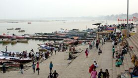
Researchers have produced a series of maps that highlight areas at risk from groundwater arsenic contamination in South-East Asia and Bangladesh.
The researchers, whose paper was published last week (11 July) in Nature Geoscience, used existing data on surface sediments and soil properties to map a variety of ‘hotspots’ in the region — some of which have not been tested previously for arsenic contamination.
The team calculated the probability of arsenic contamination using eight geological variables such as soil texture. They found that contamination was most likely in very young sediments, deposited before the last Ice Age.
"Until now, no detailed risk maps for arsenic in groundwater existed," Lenny Winkel, a researcher at Eawag, the Swiss Federal Institute of Aquatic Science and Technology, and one of the authors of the report, told SciDev.Net
"There was only one way to find out if water from a groundwater well contains arsenic and that was by sampling and analysing the groundwater — a time-consuming and costly matter."
The researchers found that their maps correlate with existing knowledge on arsenic contamination in South-East Asia and Bangladesh. But the maps also highlighted additional regions.
"There are several known areas at risk, such as the Bengal delta area, the Red River delta of northern Vietnam and the Mekong delta," Michael Berg, a co-author of the study also from Eawag, told SciDev.Net. "But these maps pinpoint areas where arsenic has not been tested for."
The new areas include the Irrawaddy delta in Myanmar and a largearea on the eastern Sumatran coast in Indonesia.
The researchers confirmed their findings by analysing groundwater tests conducted in the Irrawaddy delta in 2002, and collecting groundwater samples in the province of southern Sumatra last year.
Winkel says that these maps provide a "helpful tool" to immediately pinpoint areas that need to be prioritised for groundwater tests.
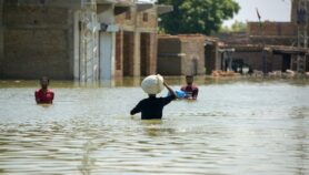
Arsenic poses a global threat to health, affecting over 100 million people worldwide. It enters drinking water supplies through natural deposits released into the groundwater. It can cause cancers, skin diseases and respiratory illness, even if ingested in small doses.
The researchers now want to apply the method to other areas including Africa and northern Asia.
Alexander van Geen, a researcher at the Lamont-Doherty Earth Institute at the US-based Columbia University told SciDev.Net that the map emphasises the problem areas rather than why there is no arsenic in other areas.
Van Geen also pointed out that the model is based on two-dimensional surface maps, whereas geological information contains a three-dimensional component — something that the authors themselves acknowledge, pointing out that in some situations, the environment at the surface differs from the geology at depth.
"The authors say there is not enough geological data to make such assertions [about why some areas are not contaminated] and I agree with them. But they could have still looked at it in some sort of depth-stratified way."
References
Nature Geoscience, doi 10.1038/ngeo254 (2008)
More on Water