By: Ola Al-Ghazawy
Send to a friend
The details you provide on this page will not be used to send unsolicited email, and will not be sold to a 3rd party. See privacy policy.
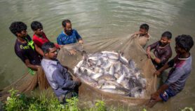
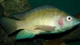
[CAIRO] Persian Gulf governments could use Google’s free global satellite imaging program to better monitor and control fishing in their waters, say experts. Their comments follow a study that used Google Earth to uncover huge discrepancies between reported and observed fish catches in the region.
The study, which tracked fishing from space, found that actual catches taken from Persian Gulf fisheries could be six times greater than the official numbers the Gulf states reported to the UN’s Food and Agriculture Organization (FAO).
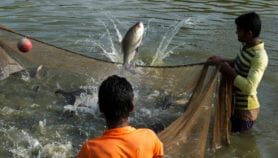
Researchers from the University of British Columbia (UBC) in Canada used Google Earth to count, for the first time, intertidal fishing weirs — an old technique used to catch fish by placing obstructions across tidal waters. They examined six countries on the Persian Gulf: Bahrain, Iran, Kuwait, Qatar, Saudi Arabia and the United Arab Emirates.
The study, which was published last year (27 November) in ICES Journal of Marine Science, highlights the unreliability of some countries’ official reports to the FAO. It found 1,900 weirs were operational in the countries surveyed in 2005 and estimated their combined production that year at approximately 31,000 tonnes of fish — more than six times the combined total of 5,000 tonnes the six countries reported to the FAO that year.
“Underreporting fish catches can jeopardise a country’s food security and economy, not to mention impact entire marine ecosystems,” says Dalal Al-Abdulrazzak, the study’s first author.
“Using Google Earth is a powerful technique … in monitoring, controlling and providing surveillance of the fishing process.”
Gamal El-Naggar,
World Fish
Al-Abdulrazzak, a PhD student at UBC, says she hopes her technique and other remote sensing satellite tools could be used to complement existing methods of monitoring fisheries and set more appropriate management targets in the Middle East and North Africa.
“Countries report their catches voluntarily to the FAO, and the quality of a country’s data is based on its national capacity to collect that data,” Al-Abdulrazzak tells SciDev.Net. A whole host of issues can affect the quality of these data, including resource limitations and political interference.
SciDev.Net asked for a comment from the Saudi Arabian department that reports these data, but received no reply.
The research team faced several challenges while gathering data. For example, some countries failed to provide complete data sets on their catches to the FAO, making comparisons with the scientists’ observed figures impossible.
And for some areas of the coast, including parts of the Iraqi shoreline, the images were of too low a resolution to be able to see the fish weirs. As a result, the researchers were unable to include these regions in their studies, so the figures may still underrepresent catches.
Yet Al-Abdulrazzak says the technique’s insights far outweigh its limitations. She says it could help enforce fishing regulations in remote or inaccessible areas. It also allows researchers to monitor fishing in poor countries that spend little on ecological management themselves, she adds.
“Using Google Earth is a powerful technique, and I think it will have a great role especially in monitoring, controlling and providing surveillance of the fishing process in many countries,” says Gamal El-Naggar, of World Fish research centre in Egypt.
Adel Ahmed Tharwat, professor of fish resources and ecosystems at King Faisal University in Saudi Arabia, says: “Gulf countries should be expanding the use of satellite remote sensing in fisheries management, as this would help in building a concrete database for fishing inventory numbers and distributions in this region.”
This satellite information, combined with field data, should help officials make appropriate decisions on managing fisheries and will become an important part of the development of fisheries and food security plans in the Gulf countries, says Tharwat.
Link to full study in ICES Journal of Marine Science
This article has been produced by SciDev.Net’s Middle East & North Africa desk.
References
ICES Journal of Marine Science doi: 10.1093/icesjms/fst178 (2013)
More on Fisheries