By: Smriti Mallapaty
Send to a friend
The details you provide on this page will not be used to send unsolicited email, and will not be sold to a 3rd party. See privacy policy.
The dazzling prospect of environmental information technologies available to everyone in the world was conjured up at the Eye on Earth Summit in Abu Dhabi this week. The vision, however, comes with a caution.
The optimistic scenario arises from a combination of geospatial technology and new online services, said Jack Dangermond, CEO and president of the US-based Environmental Systems Research Institute (ESRI).
"In our field of geospatial and environmental information systems we are seeing the emergence of much easier to use technology that is accessible, and through web and cloud computing will be available to everyone in the world," he told the meeting (12-16 December).
Geospatial technology uses the earth’s spatial location as a reference point for collection and processing of data, such as maps. One tool, the Eye on Earth network (no relation to the Abu Dhabi conference) was launched by ESRI, Microsoft and the European Environment Agency (EEA) at the recent round of climate talks in Durban, South Africa, to share environmental and geospatial data and make it publicly accessible.
Users can create and share their own maps, explained Dangermond, and "on top of these intelligible webmaps, which are going to be accessible to everyone on the planet, we can sketch different alternatives, draw around an area for additional protection and then quickly understand the impacts of that on the rest of society”.
Special watching services – WaterWatch, AirWatch, NoiseWatch – have also been designed as part of the Eye on Earth network to directly involve citizens in environmental monitoring.
Sensing applications
People can rate water, air, and noise quality to "get a sense of the community feeling," Giacomo de’ Liguori Carino, project manager for Eye on Earth at the EEA, told SciDev.Net.
NoiseWatch includes an application where anyone with a smartphone can measure noise levels and report readings onto the database.
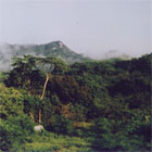
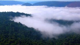
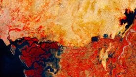
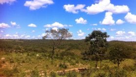
Google Earth Engine was used to create a map of Mexico’s forests
Flickr/ Melina
Google has developed similar smartphone sensing applications that have been used to aid developing countries in monitoring their forest and carbon resources.
"As you know, mobile phones are ubiquitous in the developing world," explained Rebecca Moore, founder of Google Earth Outreach, in a conference presentation. "It has turned out to be a very good way to engage with local communities in mapping, monitoring, and protecting their own landscape."
Moore said tools such as Google Earth and Google Maps had "brought a new era of geoliteracy, not just among intellectuals, but also among some of the poorest people on earth – for example to secure their land rights".
Google Earth Outreach is working on tools that can harness the company’s capacity for analysing and storing data to further support developing countries that do not have advanced technological infrastructure. One such tool, Google Earth Engine – a large public catalogue and powerful processer –was recently used to create the "finest scale map of Mexico’s forests ever produced". The mapping involved analysing 53,000 Landsat images in 15,000 computation hours.
"Because we ran it on 1,000 computers in parallel, we got the result in less than a day. Otherwise it would have taken almost three years", said Moore.
Forest map
Although industrialised countries have taken the lead in collecting and processing geospatial data, it can be used to capture information all over the world, including developing countries. However, many of the tools require other types of data that may not be as freely available to overlay onto maps.
"There is a lack of in-situ observational data available in developing countries," Jose Achache, secretariat director of the Geneva-based intergovernmental Group on Earth Observations (GEO), told SciDev.Net.
"Like we say ‘garbage in, garbage out’," commented Abdul Al Eryani, director of the Socotra Conservation Fund. "Developed countries have solved the problem of data and are more concerned with the tools. Developing countries have not reached that point yet."
In the midst of the technological possibilities and big hopes, came two reminders that certain types of data may be considered too sensitive to share.
"For example, two key areas in Europe are sources of drinking water and locations of endangered species," said Stefan Jensen, head of the EEA’s shared environmental information system and spatial data infrastructure group.
And Al Eryani reflected a problem that applies to many other countries: "In Yemen we have very good aerial data, but we don’t have access to it because those controlling the data are paranoid."
More on Earth science