By: Ochieng’ Ogodo
Send to a friend
The details you provide on this page will not be used to send unsolicited email, and will not be sold to a 3rd party. See privacy policy.
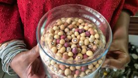
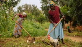
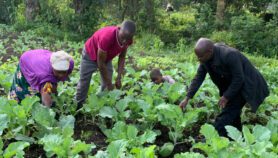
[NAIROBI] A pilot project that uses mobile phones to alert farmers in remote regions to where they can buy drought-tolerant beans has been launched in Kenya — just one of a set of pilot projects using mobile and geospatial technologies to improve communication of important information to farmers across Africa.
In the first step of the system researchers confirm where dealers are stocking drought-tolerant beans, mapping their locations. Scientists then use mobile phone services to send the information to government extension workers who have second-generation mobile phones, common in Africa. They can then relay the information to farmers in person or via their phones.
"We will produce maps which can be used by extension officers or community development workers so that this information can be passed onto farmers who wish to acquire improved drought-tolerant bean seeds," says Andrew Farrow, a spatial analyst from the International Centre for Tropical Agriculture (CIAT) based at Uganda’s Kawanda Agricultural Research Institute. He addressed the WhereCampAfrica mapping conference held at the International Livestock Research Institute in Nairobi, Kenya, earlier this month (4 April).
The project, partners in which include the non-profit company Farm Input Promotions Africa and the Grameen Foundation, is expected to end in September with feedback from participating farmers.
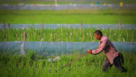
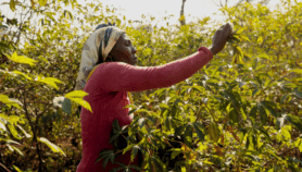
Another project, taking place in Kisumu and Homa Bay on the edge of Lake Victoria in western Kenya, uses mobile phones to provide farmers and government workers with information about the soil.
"Soil samples will be scooped and scanned using near-infra-red and mid-infra-red spectroscopy technology which can identify the electromagnetic wavelengths of various elements in the soil," says soil scientist Peter Okoth, from the Nairobi branch of CIAT.
The soil sample is given a fertility rating which is then digitally mapped and accessed by mobile phone or the Internet, using Google Map Maker.
Farmers will be able access information about the soil type in specific areas, the amount of fertiliser to apply and which seed varieties would be suitable, says Okoth.
The project is being carried out with the help of the Kenya Agricultural Research Institute.
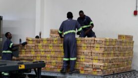
Another project improves market access for smallholders by providing the daily price for commodities at a variety of nearby markets as well as options for buying farm equipment or obtaining agriculture-related funding, says Pierre Sibiry Traoré of the International Crops Research Institute for the Semi-Arid Tropics in Mali. Farmers can also get information about the weather, crop diseases and pest outbreaks.
The drought-tolerant bean mapping project is a Quick Win project of the AGCommons initiative which aims to enhance use of geospatial information in farming. Quick Win projects last less than a year and ”essentially pave the way for larger and longer projects", says Traoré.
Other Quick Win projects are taking place in Burkina Faso, Ethiopia, Ghana, Mali, Niger and Uganda.
More on Farming