Send to a friend
The details you provide on this page will not be used to send unsolicited email, and will not be sold to a 3rd party. See privacy policy.
Satellite remote sensing data can provide crucial information for managing natural disasters. How can developing countries access and make use of these data? And what must policymakers do to prepare?
Feature
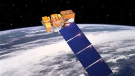
Launching your own satellite — the pros and cons
Developing nations are building their own satellites despite freely available Western data. Do the gains outweigh the costs, asks ...11/11/09
Opinion
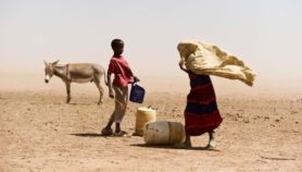
Satellites can help monitor and manage African droughts
Kenyan MP and remote sensing expert, Wilbur Ottichilo, argues the time is ripe for using satellites to spot developing ...10/11/09
Opinion
Africans need earthquake education
Africans need to be more aware of earthquakes to cope with disasters — and there's no better place to ...03/11/09
Editorials
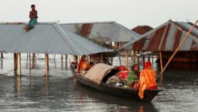
Spotlight on satellites for disaster management
Satellites can save lives from natural disasters but developing countries risk missing the opportunity through poor political support.03/11/09
Opinion
Satellites offer crucial data for volcano safety
Volcano expert Geoff Wadge explains how the International Charter on Space and Major Disasters helped manage a volcanic eruption ...29/10/09
Opinion
Disaster management needs satellite ‘constellations’
Disaster management needs constellations of satellites with multispectral sensors, says Indian space researcher, Ranganath Navalgund.29/10/09
Opinion
Fires: Spotted from satellites, warned by phone
Combining satellite data with mobile phones offers cheap and effective tools for managing fires, says South African scientist Philip ...29/10/09
More on Environment