By: Lou Del Bello
Send to a friend
The details you provide on this page will not be used to send unsolicited email, and will not be sold to a 3rd party. See privacy policy.
If you are unable to listen to this audio, please update your browser or click here to download the file [9.4 MB].
Around 300 million rural Indians live without electricity. Local energy systems, or ‘microgrids’, can be installed in small settlements not reached by the central energy system, but the process is often slow and expensive.
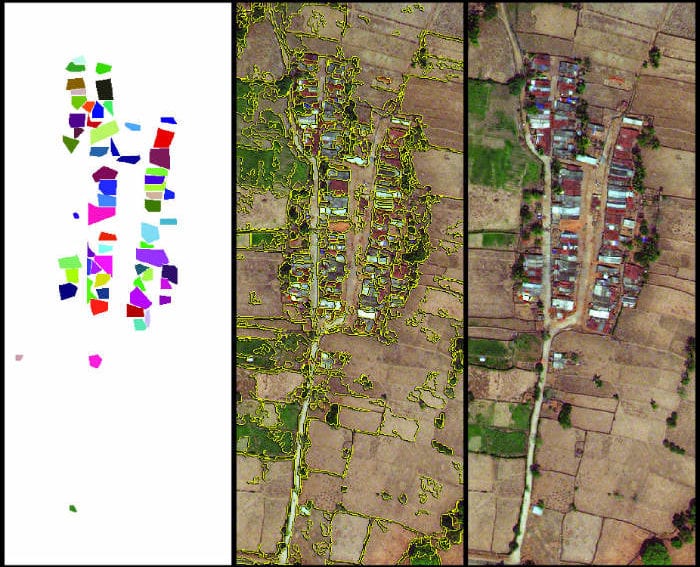
Now a team of graduate students at the Massachusetts Institute of Technology (MIT) in the United States, together with a group of data scientists, has developed a computer algorithm that interprets satellite imagery more accurately than current methods. This reduces the work needed in the field to design a microgrid that works for each unique settlement.
“An analogy could be to take a picture, lay a transparent sheet over it and make a stencil that captures the elements in the image,” says Vivek Sakhrani, an expert in infrastructure delivery at MIT. “What our automated process does is to generate the stencil and simulate a variety of ways in which the elements can be connected using a microgrid.”
The system will soon be tested in rural India, where two villages will be equipped with a microgrid using conventional methods, and two more by the automated software. The MIT team will then be able to compare the energy efficiency and cost of the new approach against the currently available technologies.


