.jpg")
By: Joshua Howgego
Send to a friend
The details you provide on this page will not be used to send unsolicited email, and will not be sold to a 3rd party. See privacy policy.
Governments are “shooting themselves in the foot” by not opening up their geospatial data, an official from the US National Academy of Sciences recently told SciDev.Net. Such data could be useful for development projects and policy, including city planning and producing disaster preparedness maps.
Better data access would be good news for the globe’s poorest people, who are often worst affected by natural disasters. So what is stopping countries getting the most out of geospatial data?
I spoke to Richard Teeuw of the University of Portsmouth in the United Kingdom, an expert on mapping using geographic information systems (GIS). Teeuw says the international community has already taken several well-intentioned steps towards opening up satellite data for use in disaster response.
The “good news for the poor is that more good, free data are on the way”, he tells me.
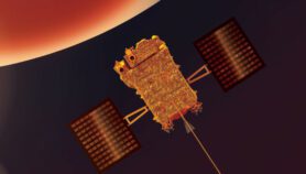
The United States has already made data from its Landsat 8 global imaging satellite free, which was “a fantastic step”. And in April this year the European Space Agency (ESA) plans to launch a radar-imaging satellite called Sentinel-1 which will allow free access to its images. Teeuw says the satellite’s data will be particularly useful because radar can penetrate clouds, allowing more comprehensive coverage, especially during hurricanes or typhoons.
Researchers can already do a decent job with freely available resources, says Teeuw. And a succession of developed-world governments that normally charge for their satellite images have agreed to release maps based on these images, for free, in the immediate aftermath of a natural disaster.
“Preparedness mapping is a key feature of disaster risk reduction: we could be doing much more of that.”
Richard Teeuw, University of Portsmouth
The International Charter on Space and Major Disasters, which codifies this agreement, was instigated in 1999. Brazil’s national space agency joined more than ten developed nation signatories in 2011.
“The charter has been applied to hundreds of disasters and has greatly assisted the relief efforts,” says Teeuw.
But responders’ capacity would vastly improve if signatories to the charter would agree to release their raw satellite image data after a natural disaster. As things stand, space agencies don’t do this, instead releasing maps which they produce themselves from up to date images of disaster-affected areas.
“This works, but it’s not ideal,” says Teeuw. “It is understandable that agencies want control over how their data are used,” but there are map-making humanitarian organisations such as MapAction that could process the data themselves and get more out of it.
“Another issue is that the charter is primarily focused on disaster response, and is not geared-up for preparedness mapping," he says, estimating that for every amount spent on planning for natural disasters, losses worth between four and ten times that figure are avoided. “Preparedness mapping is a key feature of disaster risk reduction: we could be doing much more of that.”
Teeuw’s research group is also pushing for developing countries to be able to develop their own preparedness maps. The team has developed a free guide to geoinformatics for disaster management, which they hope could aid such efforts. [1] According to the guide, capacity to do this hinges on access to data, software and training. Since each of these is, at least to some extent, freely available online, Teeuw says the most pressing bottleneck is access to internet speeds fast enough to handle large files.
Joshua Howgego is SciDev.Net’s Deputy News and Opinions Editor.
See below for a video about the UN’s Platform for Space-based Information for Disaster Management and Emergency Response (UN-SPIDER):
References
[1] Mathias Leidig and Richard Teeuw Quick Guide to Free Geoinformatics for Disaster Management (University of Portsmouth UK, 2012)
More on Data