By: T.V. Padma
Send to a friend
The details you provide on this page will not be used to send unsolicited email, and will not be sold to a 3rd party. See privacy policy.
[TURIN, ITALY] Scientists are pooling remote-sensing satellite data and geographical information services for two pan-African digital observatories that will provide accurate and readily accessible information on biodiversity and forest cover for policymakers.
Under a grant awarded in 2009, the European Commission’s (EC) Joint Research Centre (JRC) is supporting the development of the observatories, details of which were discussed at the fourth EuroScience Open Forum (ESOF 2010) yesterday (5 July).
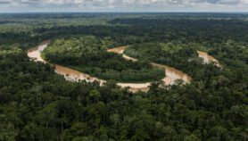
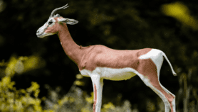
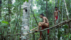
One is the Observatory for the Forests of Central Africa (OFAC), which aims to serve as a single reference centre for scientific and technical information to help develop policies and programmes on the sustainable management of biodiversity, forest cover and food security in Central Africa‘s forests, which support around 40 million people.
It will help bridge the knowledge gap by providing easily accessible information for policymakers, Paolo Roggeri, staff member from the JRC told the forum.
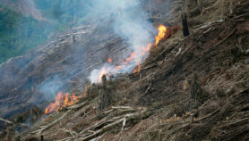
European satellites will provide data on vegetation cover and drought to help track deforestation, desertification and land degradation — including illegal logging in the region.
The portal will be divided into themes such as soil, forests, drylands, agriculture, biodiversity, and disasters, and each theme will contain reference maps, specific analysis of development issues and related scientific topics.
The observatory will also train local foresters in collecting baseline data.
The other initiative supported by the grant is the Digital Observatory for Protected Areas (DOPA), an online information system aimed at helping policymakers assess the state of protected areas and prioritise interventions in natural parks supported by the European Union.
The digital observatory is designed as a set of web services that help assess, monitor and forecast the vulnerability of large ecological systems, and will cover the entirety of Sub-Saharan Africa.
"The assumption that information is accurate and available is a fallacy," Alan Belward, head of the Global Environment Monitoring unit, at the JRC’s Institute of Environment and Sustainability, told the ESOF session. "It is the duty of scientists to fill the gap."
Samy Mankoto, president of the Network of Protected Areas of Central Africa (RAPAC), added that it is important to have good scientific indicators for decision makers.
And Carlo Paolini, a biodiversity and conservation consultant based in Italy, highlighted the need to have context-specific analyses of loss of forests or biodiversity in different parks, the absence of which makes it difficult for technical staff to identify and prioritise appropriate intervention strategies.
Mohammed Hassan, executive director of the Academy of Sciences for the Developing World (TWAS) told SciDev.Net that he believed the problem of poor Internet connectivity, which could impede use of such data, should not be a problem, as some have suggested, as it is improving and spreading widely throughout the continent.
More on Biodiversity