By: Sandy Ong
Send to a friend
The details you provide on this page will not be used to send unsolicited email, and will not be sold to a 3rd party. See privacy policy.
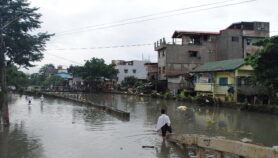
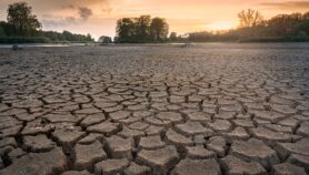
[MANILA] Sixteen-year-old Ramilmarko Tolledo was watching television one September morning in 2009 when he noticed water seeping up through the marble flooring of his living room floor in Marikina City. The Tolledo family lost no time fleeing to higher ground as their house rapidly filled with water and mud was forced in by tropical storm Ketsana, known in the Philippines by its local name Ondoy.
The Philippines is one of the most storm-hit countries in the world, experiencing as many as 20 tropical storms each year. In 2017, typhoons and related calamities in the country caused an estimated US$120 million in damages to agriculture and infrastructure.
“Within 3 to 4 hours, the water rose to chest level…and I’m six-foot [tall],” says Tolledo, who recalls seeing animals — dogs, cats and rats — flowing past him in the rapid current. It took days before the mud could be removed from his house and valuables salvaged.
“We thought that maps like these would show the streets and waterways that are still there or have vanished.”
Maricor Soriano, University of the Philippines Diliman
The country’s flooding problem following tropical storms and other meteorological events is exacerbated by poor developmental planning, according to landscape architect and urban planner Paulo Alcazaren.
This includes poorly maintained drainage systems, informal settlers encroaching into waterways, and a lack of green spaces to absorb storm water. But one of the main factors responsible “for flooding in many parts of the country’s 145 cities and nearly 1,500 towns is…the loss of waterways,” says Alcazaren.
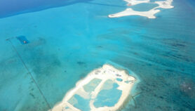
Waterways lost and found
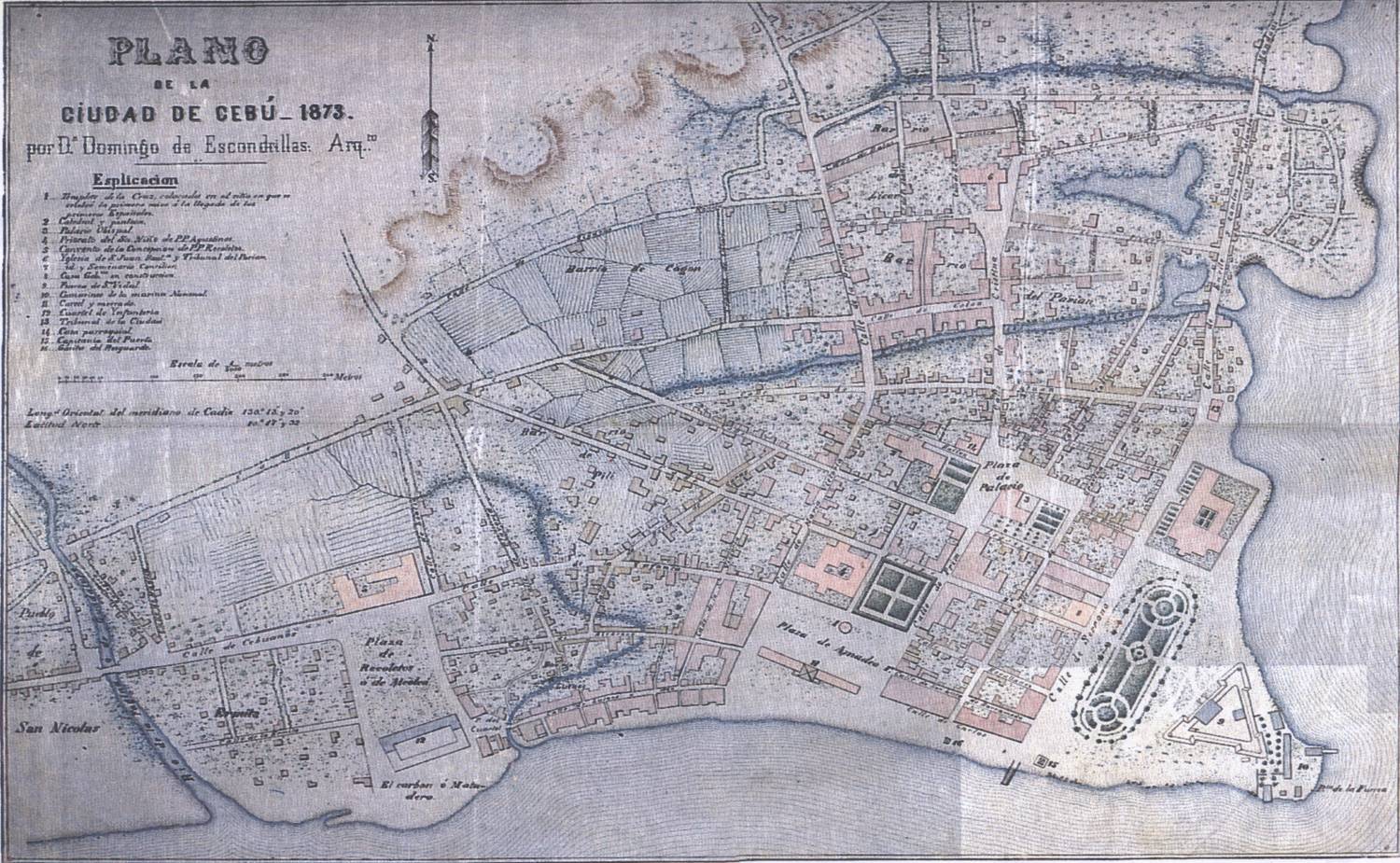
Map credit: National Archives of the Philippines.
To address this problem and to help prevent future flooding, researcher Maricor Soriano decided to get some help from the past. In a report published Monday (17 December) in arXiv.org, the applied physicist from the University of the Philippines Diliman detailed how her team obtained old maps — made in the 19th century and after World War II when the Philippines was under Spanish and American rule, respectively — digitised and superimposed on present-day Google Maps.
“We thought that maps like these would show the streets and waterways that are still there or have vanished,” says Soriano, who launched the project Cartography of Old Informs the New in March last year.
Lagoons, rivers, and other water bodies can disappear and get filled in over time due to natural processes such as sedimentation or by human-driven ones as cities grow and expand. Buildings constructed on top of old waterways may be more prone to flooding during extreme weather events or face an increased risk of ‘liquefaction’ during earthquakes due to the soft soil underneath.
“By identifying lost waterways, we can provide a map of potential flooding and liquefaction hazards, down to the street level for disaster mitigation,” Soriano explains.
A new normal
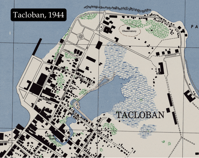
Credits: 1944 map – University of Texas Libraries; Processed maps – Cartography of Old Informs the New Project team; GIF – Elexis Mae Torres
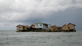
Soriano and her team studied six cities — Cebu, Davao, Iloilo, Manila, Naga and Tacloban — and conducted site visits to verify their findings. They found evidence of “affected buildings, rainless flooding, and a ‘new normal’ for flooding among frequently inundated residents,” says Soriano.
In Iloilo city, some 290 miles southeast of the capital Manila, for example, the team visited a street that, according to a map drawn in 1833, used to be a backwater of the Iloilo River. They highlighted the buildings being put up in areas at high risk for liquefaction. The city mayor affirmed their findings and told them how construction for a five-storey building had to be halted because the building had begun to tilt.
On the same visit, the team also observed culverts being installed and numerous coverings on the road for underwater sewage lines. These ongoing works, local officials explained, were part of continuing efforts to improve the drainage systems in an area prone to frequent flooding.
In Davao and Cebu, overlaid maps of the two cities identified areas where rivers previously flowed and lagoons once stood. These areas in Davao are now diverted elsewhere to the sea; the ones in Cebu have been filled in to make way for development. Chats with locals in these areas revealed frequent experiences with floods, sometimes waist-high, despite the absence of heavy rain or typhoons.
In other areas such as where estuaries of Manila’s Pasig River once flowed, locals report being so used to getting inundated by floods that ankle-deep water is no longer considered an instance of flooding. “It’s possible that the locals have already developed a different baseline for the meaning of flooding,” says Soriano.
“We know that urbanisation makes creeks, streams and natural drainage channels disappear,” says Alfredo Mahar Lagmay, a geologist at the National Institute of Geological Sciences and program leader and executive director of the Philippines’ Project Nationwide Operational Assessment of Hazards (Project NOAH). “[This enhances] flooding, especially in the coastal areas of old Manila.”
“Soriano’s research on the effect of urbanisation on the loss of canals, wetlands, mangroves are important for an understanding of the problem,” says urban planner Alcazaren. “The solutions are harder to craft together given the local political dynamics and rapidity of urban growth of our towns and cities.”
Other experts cite the need for more impactful solutions. These include improving pumping stations, unclogging solid waste from waterways, and boosting green infrastructure, enumerates World Bank lead irrigation engineer Joop Stoutjesdijk. “Having these small waterways covered up from the Spanish time…that’s only a very small part of the issue,” says Stoutjesdijk, who is spearheading the Metro Manila Flood Management Master Plan, which aims to improve flood management. “I have nothing against the technology and methodology — I like what they’re doing.”
Soriano admits it’s “sometimes too late” for cities that have already been built over waterways. “You can’t expect them to rebuild, destroy or dismantle their houses.”
With more funding, she hopes to obtain and study more 20th century maps — those created by the US Army in the 1940s or later. Rather than being hand-drawn, these are based on aerial photography, making them easier to align with present-day maps, Soriano says. Furthermore, these maps “contain very rich information” thanks to the greater detail captured.“We’re still looking at new data because we’re hoping to reach those who are in the middle of development,” says Soriano. At least we can warn upcoming cities and their local governments and tell them: “Hey watch out, don’t give permits here, please, because these are hazardous places to build on.”
This piece was produced by SciDev.Net’s Asia & Pacific desk.
More on Vulnerability