By: Shahani Singh
Send to a friend
The details you provide on this page will not be used to send unsolicited email, and will not be sold to a 3rd party. See privacy policy.
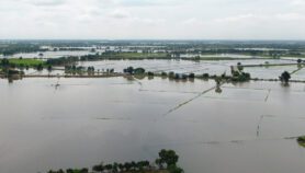
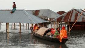
[PARIS] International Mountain Day, coinciding with the close of the COP21 climate conference in Paris, this week, saw the launch of an atlas mapping out the impact of climate change on Asia’s five major river basins — Brahmaputra, Ganges, Indus, Mekong and Salween.
Consisting of maps, visualised data, photographs and written text and stories on past, current and future projections of the impact of climate change in the region, the ‘Himalayan Climate and Water Atlas’ foresees temperatures rising across the mountainous Hindu Kush Himalayan (HKH) region will increase by about 1–2 degrees Celsius (in some places by up to 4–5 degrees) by 2050.
“If global temperature increases by about four degrees Celsius or more above late 20th century-levels, climate change combined with increasing food demand would pose large risks to food security globally,” the publication says in one of its many prognoses.
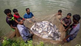
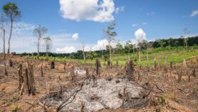
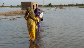
Precipitation in the HKH region, too, is expected to change with the monsoons likely becoming longer and more erratic, and extreme rainfall events expected to be less frequent, but of greater intensity, according to the atlas. Higher incidence of unexpected floods and droughts with far-reaching consequences for climate-dependent sectors, such as agriculture, water resources and health, are also projected.
 Click on image to enlarge
The atlas will “help develop solutions and take necessary action for the region,” says David Molden, director-general of the Kathmandu-based International Centre for Integrated Mountain Development (ICIMOD), one of three organisations involved in producing it.
“The goals of presenting information through products such as these are to clearly convey some key messages — the information presented is more visual and relies less on text and more on graphics,” says Björn Alfthan, programme leader of the Polar and Cryosphere Division of GRID-Arendal, a Norwegian foundation that was also involved in the producing the atlas.
Along with the latest scientific information from the region, the atlas also provides six key policy recommendations to encourage cooperative strategies — including between countries — to tackle climate and water hazards. Recommendations stress regional coordination, data sharing, and putting mountains on the global climate change agenda, among others.
“Mountains and their importance as water towers for the world should be higher on the global climate change agenda,” Børge Brende, Norway’s minister of foreign affairs. “We are confident that the Himalayan Climate and Water Atlas will help raise the visibility of mountains in the global climate change discourse”.
More on Climate change