10/12/20
Ancient trees reveal Brahmaputra mega-dam risks

By: Ranjit Devraj
Send to a friend
The details you provide on this page will not be used to send unsolicited email, and will not be sold to a 3rd party. See privacy policy.
[NEW DELHI] Scientists warn in a new study that the potential for catastrophic flooding in the Brahmaputra — a transboundary river across which China and India plan to build mega-dams — may have been underestimated.
Published 26 November in Nature Communications, the study involved examination of the rings of ancient trees in and around the river’s watershed, covering Bangladesh, Bhutan, India, Myanmar, Nepal and Tibet autonomous region, which showed that the post-1950s period has been one of the driest over the last 700 years.
“The tree rings suggest that the long-term baseline conditions are much wetter than we thought,” says Mukund Palat Rao, lead author of the study and a recent PhD graduate of Columbia University’s Lamont-Doherty Earth Observatory. “We should be prepared for a higher frequency of flooding than we are currently predicting.”
“The tree rings suggest that the long-term baseline conditions are much wetter than we thought”
Mukund Palat Rao
The study comes as China announced plans to go ahead with the construction of a mega-dam across Yarlung Zangbo, the upper stream of the Brahmaputra flowing through Tibet, dismissing protests by India that the project could disrupt downstream flows into Arunachal Pradesh and Assam states and also Bangladesh.
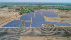
On 30 November, Global Times, China’s state-run daily, reported that the dam is to be designed by Chengdu Engineering Corporation under POWERCHINA and will have three times the generating capacity of the Three Gorges hydroelectric project — the world’s largest at 22,500-megawatts.
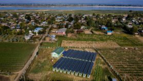
Not to be outdone, India announced on 1 December plans to build its own 10,000-megawatt hydropower project on the Siang, as the Brahmaputra is called in Arunachal Pradesh state. The Press Trust of India news agency quoted T. S. Mehra, a high-ranking official in the Jal Shakti (hydropower) Ministry as saying that the project will “offset the impact of the hydropower project by China”.
Rao tells SciDev.Net that the dam in Tibet would not have a large impact on monsoon season flows because most precipitation originates south of the Himalayas. “However, any diversion of flow would negatively impact dry season flow which is derived from snow and glacial melt from the Tibetan plateau.”
A major concern is loss of sediment, says Rao. “The river has one of the highest sediment loads in the world. These sediments are crucial to sustaining the fertility of the floodplain and maintaining the large riverine islands. Dams inevitably trap sediments and this could, in the long run, threaten the integrity of the inhabited riverine islands.”
Other large risk factors for dam building in the area, says Rao, include the fact that “the region is active tectonically and that the Brahmaputra is a highly braided river that migrates its course quite often”.

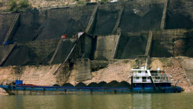
The Brahmaputra routinely floods areas around it during the July to September monsoon season when moisture-laden winds sweep in from the Indian Ocean and bring rain along the length of the river which is augmented by Himalayan headwaters.
For the study, core samples were taken from ancient trees at 28 sites within the Brahmaputra watershed and analysed at the Lamont-Doherty Tree Ring Lab. Since tree rings grow wider in years when soil moisture is high, reflecting rainfall and river runoff, the scientists could assemble a 696-year chronology up to 2004. By comparing the rings with modern instrumental records as well as historical records, they could establish that the widest rings matched known flood years.
According to the authors, higher temperatures drive up more evaporation from the oceans resulting in more precipitation with the monsoon rains and increased flooding south of the Himalayas.
Flooding in the Brahmaputra has increased in recent years not only because of heavier monsoon rains but also because the population and infrastructure around it have been growing fast, the authors noted. “High discharges will continue to be associated with an increased likelihood of flood hazard in the future,” the authors wrote in the study.
C.P. Rajendran, top paleoseismologist and adjunct professor at the National Institute of Advanced Studies, Bangalore, says: “Proxy data obtained using tree rings between 1309 and 2004 reveal the long-term hydroclimate variability in the Brahmaputra river system and demonstrate that the early period when instruments were used (1956—1986) ranks amongst the driest of the past seven centuries.
“The model simulations suggest amplified precipitation over the Brahmaputra river basin, leading to increased discharge towards the end of the 21st century,” Rajendran tells SciDev.Net.
The Brahmaputra combines with the Ganges river to create the world’s third largest ocean outflow, behind the Amazon and the Congo in discharge. At points, the river is 20 kilometres wide and with 130 million Bangladeshis living on its delta and several millions more upstream.
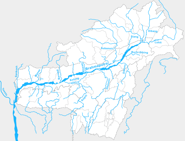
The Brahmaputra river basin. Image credit: Renzut (CC BY 3.0).
Rao says that where dam building is concerned there is a need for better sharing of data among Bangladesh, China and India. “Especially since the upstream countries, China and India, have more control over the water resources,” he adds.
Flooding hits low-lying Bangladesh hardest, the study points out. Two-thirds of the country went underwater in 1998, destroying crops, roads and infrastructure. Floods in September affected a third of Bangladesh and left three million people homeless.
But reduced river water flows in deltaic Bangladesh could also be problematic.
“A reduction in dry season flow by a dam would raise concerns about saltwater intrusion in the low-lying Sundarbans delta [which straddles India and Bangladesh]. Since the delta is so low- lying, the main factor holding back the saline waters from the ocean is the high rate of river discharge,” says Rao.
This piece was produced by SciDev.Net’s Asia & Pacific desk.
More on Energy


