Send to a friend
The details you provide on this page will not be used to send unsolicited email, and will not be sold to a 3rd party. See privacy policy.
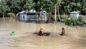
[JAKARTA] When a powerful earthquake shook Indonesia on Wednesday night (2 March), local scientists quickly tapped social media to contain panic that a great tsunami would result like what happened in Sumatra island in 2004.
The epicentre of the 7.8 magnitude earthquake was located 800 kilometres from the coastal city of Padang, West Sumatra. Indonesia’s Agency for Climate, Meteorology and Geophysics (BMKG) released an “early tsunami warning” in Sumatra, causing thousands of people to immediately evacuate from Padang and in Meulaboh, Aceh, which had the highest number of casualties in the 2004 tsunami.
Abdul Muhari, an expert in tsunami science at Indonesia’s Ministry of Marine Affairs and Fisheries, was among the first scientists to turn to social media to clarify the tsunami warning and calm the public with scientific evidence that the earthquake would only create minor tsunami, which is negligible.
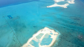
Using Facebook and Twitter, Muhari posted a picture from the UNESCO International Oceanographic Commission (IOC), showing that the earthquake only created a 10-centimetre minor tsunami in Cocos Island and a 20-centimetre minor tsunami in Christmas Island.
Both islands, which are Australian territories located in the Indian Ocean, were the nearest spots from the earthquake source.
“As soon as there was an early warning about the tsunami, I checked the sea level data at the IOC to confirm the real situation out there and I found the data from Cocos and Christmas islands,” Muhari tells SciDev.Net.
He says it was unfortunate there was no data from Indonesian islands near the earthquake spot, such as Mentawai, Tanah Bala and Enggano, although Indonesia’s Geospatial Information Agency (BIG) has committed to provide sea level data to the IOC.
“Our tsunami detection system didn’t work during the event. Whenever there’s a disaster, the device just doesn’t seem to work,” Muhari rues. “I think we are poor in terms of device maintenance.”
Another scientist, Endra Gunawan, an expert in earthquake geology from the Bandung Institute of Technology (ITB), also filled in the data gap by posting a picture on Facebook of how the earthquake would affect Sumatra.
Like Muhari, he told people to calm down because the earthquake was not a “megathrust” earthquake like the 2004 Sumatra earthquake, which occurs in subduction zones where two crustal plates are colliding.
“It was not a megathrust earthquake because it happened outside the subduction zone. I could see this when the BMKG released the picture of the earthquake source,” Gunawan explains.
As soon as he heard the news of the earthquake, Gunawan says he ran to his computer to model the change in Sumatra geology. On his Facebook page, he showed that the earthquake has moved Sumatra 2 centimetres from its previous place — a significant movement as it covered a third of its annual movement rate of 6-7 centimetres.
This piece was produced by SciDev.Net’s South-East Asia & Pacific desk.
More on Disasters