By: John Waugh
Send to a friend
The details you provide on this page will not be used to send unsolicited email, and will not be sold to a 3rd party. See privacy policy.
Improving access to information technology can help communities assess their own vulnerability and boost local planning, says John Waugh.
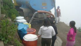
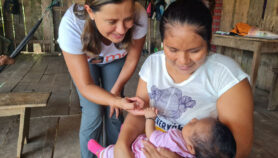
Climate change affects virtually all of the natural systems necessary for human survival. It has implications for water supply, food production, health and physical security. Climate impacts will vary from region to region, so planning for adaptation must be context specific, often local.
The scale of potential impacts is vast, and nations are already hard-pressed to find the resources they need to respond. Without adequate support at the national level, communities must become more self-reliant — it makes little sense to wait for instructions.
It is more cost-effective to improve communities’ access to information and technology for participatory planning, such as maps. Modest investment will increase their ability to assess local vulnerability to the impacts of climate change, strengthen their resilience, and extend the reach of national adaptation plans.
Grassroots innovation
Maps can be used to organise and convey complex information in a way that supports assessments of vulnerability in areas threatened by climate change.
Several networks support community mapping, with tools ranging from paper maps to balloon and kite mapping using digital cameras, desktop software and global positioning system (GPS) technology.
They focus on grassroots innovation, giving communities and local authorities the latest data and fresh perspectives for planning.
PPgis.net, for example, is an open forum on participatory geographic information systems (GIS) and technologies. The Public Laboratory for Open Technology and Science, and its sister group, Grassroots Mapping, build on the ethos of the software movement.
Grassroots Mapping was formed in response to the Deepwater Horizon oil spill in the Gulf of Mexico, where it provided more detailed and timely information on environmental impacts than either the government or industry. It has since evolved into an international network of aerial mapping practitioners.
Mapping tools
Open-source GIS software is a valuable tool because it is widely available and accessible to communities. A concerted effort to train more people to use it would help to overcome a potential barrier to effective participatory mapping: the extraordinarily high costs of licences for commercially available GIS products, which puts them beyond the reach of most communities.
Data Basin, for example, is a free online service that allows scientists, planners and stakeholder groups to collaborate, explore and share data, and produce customised maps.
TerraLook, a tool developed by the US space agency NASA and the US Geological Survey, provides free remote sensing imagery and simple tools that can be used to view and manipulate the images.
Using these tools, communities can map their resources and compare them with a range of existing climate models to develop scenarios, assess risks and develop their own response strategies.
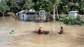
A farming community can learn how droughts and floods could affect their land, for example, and coastal communities can plot the extent of expected sea-level rise and storm surges.
Regional networks
To benefit from these resources, communities should organise themselves through grassroots networks to complement national planning. Grassroots and centralised systems can leverage one another to strengthen their impact.
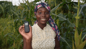
Governments and international organisations can provide support for activities designed to boost capacity for adaptation planning, such as peer-to-peer learning networks and training in the use of GPS and open-source GIS.
They should make climate and geographic data publicly available and explicitly sanction their use in grassroots mapping.
Government satellite data providers should do more to share Earth observations in accessible formats at little or no cost, building on the example of TerraLook. Clearinghouses could also be set up to provide low-cost, high-quality data and tools.
Financial and technical support for such initiatives in the developing world could come from adaptation funds being established by multilateral financial institutions, as well as bilateral donors.
Regional organisations also have a role to play. The Pacific Regional Environment Programme (SPREP), the UN Environment Programme’s Regional Seas Programme, forestry bodies such as COMIFAC in the Congo Basin, and watershed organisations such as the Nile Basin Initiative, already support some elements of the interventions required.
Regional centres of excellence can support innovation and dissemination, provide training and technical assistance for participatory approaches, and develop pilot programmes to demonstrate how they can be used for planning.
Local knowledge
Identifying priorities for adaptation planning at the local level improves the chances of them receiving strong support. And participatory plans are easier to adapt to changing conditions or new information.
Governments can also benefit from fine-grained local information that is too detailed to be reflected in official data. It can provide much-needed insight into traditional ecological knowledge, use patterns for natural resources, and features too detailed to be reflected in some official data.
In addition, allowing communities to assess their own vulnerability frees national governments to do things that communities cannot do.
Some aspects of adaptation, such as adaptation at ecosystem scales, fall outside the competency of communities alone. And a community-based approach is not a substitute for a technically rigorous national approach to climate change adaptation. But it can be a powerful complement.
John Waugh, based in Virginia, USA, is an independent adviser on conservation strategies and planning. His recent work addresses community co-management of conservation areas, participatory mapping, and benefit-sharing arrangements in Africa and Small Island Developing States.
More on ICTs