By: Puneet Kollipara
Send to a friend
The details you provide on this page will not be used to send unsolicited email, and will not be sold to a 3rd party. See privacy policy.
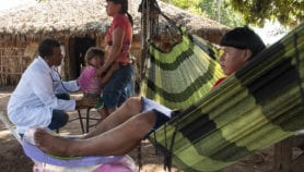
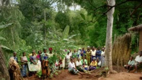
[WASHINGTON DC] An interactive online map that shows which lands are held by indigenous people and local communities was launched this month.
The map is a global effort to gather and publish data on indigenous land rights, and its backers hope it will promote indigenous efforts to access land they have traditionally used and combat deforestation.
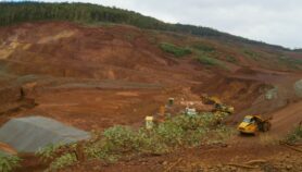
The LandMark map is, however, far from complete, according to the Rights and Resources Initiative, a US-based advocacy coalition and one of 13 organisations running the map. The partners hope that, as new data and features are added, the map will yield international benefits — for example by holding logging and mining companies to account over the lands they prospect in.
“The map gives indigenous people an instrument to confront the government and companies, or to negotiate among themselves, how their land is going to be used, and why and by whom”.”
Alda Salomão, Centro Terra Viva
“I don’t think you can overestimate and over-project how useful this map will be,” said Andy White, coordinator of the Rights and Resources Initiative, at a launch event on 10 November in Washington DC, United States.
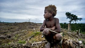
The map shows that around 65 per cent of the world’s land is informally tended by indigenous people, yet only ten per cent legally belongs to such groups. This may be because national governments do not recognise informal land arrangements, the law may not allow formal recognition or the indigenous tenants might not know that they can legalise their use, the map’s curators say.
Even when land ownership is legally recognised, boundaries may not be publicly known or enforced, making the land vulnerable to encroachment, the map’s partners say.

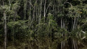
Indigenous land rights in the Amazon Basin
Efforts to increase awareness of land rights are made harder by a lack of available data, the launch event heard. The data set is far from complete, said Katie Reytar, a forestry researcher at US-based think-tank the World Resources Institute, another partner. Many countries, particularly in Africa, have no data at all.
Data submissions come from volunteers, but the LandMark partners are still figuring out how to vet them, Reytar said.
“The platform is timely, but we have to make sure the data is as complete and accurate as possible,” said Fabrice Dubertret, the principal operator of the France-based World Atlas of Indigenous Peoples’ Territories project.
Despite the growing pains, indigenous advocacy groups welcomed the map, saying that information on land rights and boundaries is vital when fighting for their recognition.Alda Salomão, director-general of the Centro Terra Viva, an environment advocacy group in Mozambique, said the map gives indigenous people “an instrument to confront the government and companies, or to negotiate among themselves, how their land is going to be used, and why and by whom”.
“I think that this tool is very important,” she said.
More on Indigenous