By: Prime Sarmiento
Send to a friend
The details you provide on this page will not be used to send unsolicited email, and will not be sold to a 3rd party. See privacy policy.
[HANOI] Two online mapping applications, designed to support sustainable production in Indonesia by helping to identify degraded lands that could be used to produce palm oil, were launched by the US-based World Resources Institute (WRI) last month (30 October).
The Forest Cover Analyzer and Suitability Mapper aim to support government efforts to reduce deforestation in Indonesia.
Through the Suitability Mapper, various stakeholders — including palm oil producers, investors and government planners — can use a customisable map to help them locate tracts of degraded, low-carbon land that were cleared of natural vegetation years ago but are now suitable for palm-oil cultivation.
Users of the Forest Cover Analyzer can view changes in forest cover over time in areas of their choice, using up-to-date satellite data. This allows companies to assess whether a specific area contains forest that has high conservation value and so should not be used for palm oil production.
"These tools will support industry and government leaders in Indonesia who are working to improve the global perception of the sustainability of palm oil by breaking the link between palm-oil production and deforestation," says Beth Gingold, research leader for WRI’s Project POTICO (Palm Oil, Timber, Carbon Offsets).
Wilmar International, one of the world’s biggest palm oil exporters, welcomes the launch of these online tools.
"Several RSPO (Roundtable on Sustainable Palm Oil) members, including Wilmar, have made commitments [that there will be] no new development on peat areas. The WRI tool can assist the due diligence phase so companies’ commitments can be met," says Calley Beamish, Wilmar’s senior manager for sustainability.
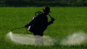
Indonesia is the world’s biggest palm oil exporter, supplying more than 20 million tonnes of palm oil every year, bringing in about US$20 billion in annual revenues. But the rapid expansion of oil palm plantations has led to deforestation as producers clear forests to make way for the lucrative cash crop.
Concerns over global warming and the growing demand for sustainably produced palm oil compelled the Indonesian government to issue a two-year moratorium in May 2011 on the awarding of new concessions for the exploitation of primary natural forests and peat lands.
Gingold says the tools developed by WRI will make it easier for industry participants to supply palm oil to a more eco-conscious market.
"Many large buyers and governments are concerned about greenhouse gas emissions from deforestation and have pledged to reduce deforestation in their supply chains. Companies who can demonstrate that production has not been linked to deforestation are in a better position to supply palm oil to these large buyers," she says.
Gingold adds that these tools will also benefit Indonesia’s farmers who rely on oil palm cultivation for a living.
At present, the mapping applications only cover the province of Kalimantan, a key area for oil palm cultivation. Gingold says that the WRI is working to expand the tools to cover other parts of Indonesia.
The WRI is also working with developers to make these web-based applications available on other platforms, she says.
The Forest Cover Analyzer was developed by the WRI’s Project POTICO, in partnership with the Rainforest Alliance, SarVision, the University of Maryland, Sekala, and the Puter Foundation.
This article has been produced by SciDev.Net’s South-East Asia desk.
More on Farming