By: Smriti Mallapaty
Send to a friend
The details you provide on this page will not be used to send unsolicited email, and will not be sold to a 3rd party. See privacy policy.
[KATHMANDU] A team of Nepali and international researchers has developed a risk assessment method to manage the threat of devastating floods that can be triggered by a glacial lake outburst (GLOF).
The new method, tested on glacial lakes in Nepal, is expected to help the country’s government develop a national strategy for GLOF pre-disaster management.
National strategies for disaster risk management broadly address GLOF hazards, while specific guidelines for managing glacial lake flooding are being conceived.
Current research on glacial lakes in the region does not follow a systematic, coordinated and standardised process, according to Pradeep Mool, a remote sensing specialist at the International Centre for Integrated Mountain Development (ICIMOD), the lead facilitating organisation of the initiative.
"One of the advantages of this step-by-step method is that it can be applied across the Hindu-Kush-Himalayan region," Mool told SciDev.Net.
The new risk-based approach, developed and detailed in Glacial Lake and Glacial Lake Outburst Floods in Nepal, an ICIMOD publication released last month (April), minimises uncertainties around predicting the occurrence of natural disasters in an environment constrained by limited manpower and financial resources.
Lakes are classified according to degree of risk by identifying the magnitude and frequency of a possible hazard in relation to the vulnerability of exposure for downstream communities.
The researchers identified six high-, four medium- and eleven low-priority lakes in Nepal, and further selected three high-priority lakes — Imja Tsho, Tsho Rolpa and Thulagi — for detailed field investigations. They found all three lakes to be relatively stable, based on measurements of the physical conditions of the moraine dam, water volume, triggers and hydrometeorology.
The new method expands on these earlier findings and uses water modelling techniques to simulate a possible breach of the moraine dam that contains a glacial lake.
"Previously, downstream vulnerability assessments were conducted only on an ad-hoc basis," explained Mool.
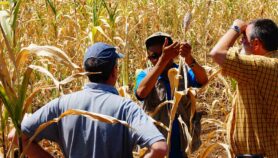
Scientists held discussions with the local population in hazard zones to quantify exposure. "We asked key informants in each mapped zone to identify the number and size of each household, annual crop production, kilometres of trail and road, and other infrastructure," said Narendra Khanal, professor at the department of geography, Tribhuvan University, Kathmandu.
Inundation, erosion and landslides could endanger between 1,000 and 8,000 people, depending on the downstream population density, while environment and infrastructure damage could further affect between half and two million people.
A GLOF event could damage up to US$400 million worth of real estate, agriculture, public infrastructure and revenue. Estimated loss was particularly significant in the Imja Tsho lake area, visited by more than 30,000 tourists annually, with a revenue stream of almost nine billion dollars.
They also assessed local resilience and capacity for recovery by qualitatively analysing “the presence of disadvantaged or marginalised groups, availability of food, land holdings, and access to education, communication and decision-making,” added Khanal.
Link to ICIMOD publication ![]() [1.70MB]
[1.70MB]
More on Water