By: Philip Frost
Send to a friend
The details you provide on this page will not be used to send unsolicited email, and will not be sold to a 3rd party. See privacy policy.
Combining satellite data with mobile phones offers cheap and effective tools for managing fires, says South African scientist Philip Frost.
South Africa, like much of the continent, is home to fiery landscapes that frequently burn. Many of these fires are not ‘disasters’ as such — indeed they are a necessary part of the ecosystem.
But an intense fire in the wrong place can be a big disaster and wildfires kill people and destroy property and grazingevery year in South Africa.
They also damage key infrastructure such as electricity networks. Fires are the second biggest cause of power line faults in South Africa after lightning. If a fire burns beneath a live power cable it not only causes havoc with the grid but causes spikes in the system that can damage equipment all over the country.
Spotted by satellite
So there is a real need to detect and provide early warning of fires here. Remote sensing can help — polar-orbiting satellites in particular, such as MODIS (moderate resolution imaging spectroradiometer), are very accurate and can locate burning fires to about 200m precision four times a day.
This is not quite good enough for early warning — what if there is a cloud covering the fire when the satellite passes overhead, or a fire starts just after it has gone?
That’s when data from geostationary satellites step in. Meteosat second generation weather satellites offer coarser (~3km) and less sensitive fire information — but they provide it every 15 minutes. They won’t pick up very small fires — but as far as disaster management goes, those aren’t the ones we’re interested in.
The problem for fire management then, is how to get this information into the hands of disaster managers, firefighters, farmers and forest managers who need warnings of where a fire is, and where it’s heading.
Fire alerts by phone
In South Africa, the Council for Scientific and Industrial Research (CSIR) has developed the Advanced Fire Information System (AFIS) to do just this. The system combines satellite data with mobile phone technology to provide crucial early warnings.
It uses both MODIS and Meteosat data to detect hotspots, compares these with background temperatures to filter out non-fires (such as chimney stacks) and uses wind vector information to work out the trajectory of active fires. It then automatically alerts people via email and text message.
AFIS was originally developed for Eskom — South Africa’s largest power company — to help combat line faults caused by fires. But since 2007 it has also been used to improve broader fire-fighting efforts. For example, it sends alerts to more than 40 fire protection associations across the country and forms part of the weekly weather forecast on national television.
The service is completely free and anyone can sign up to receive alerts within their area. So, for example, AFIS is alerting farmer conservancies — self-organised groups that take on fire management responsibilities and pool fire-fighting efforts.
And it is also helping poverty alleviation efforts. For example the government-funded Working on Fire (WoF) project includes AFIS when working with rural communities. WoF offers technical training in fire-fighting and safety as well as organisational training in how to set up a commercial fire response team and notify people of the service. The teams it trains fulfill a seasonal need for fire protection while generating income for rural communities.
Spreading like wildfire
AFIS has clearly improved fire management in South Africa. Two questions remain.
First, can the idea be exported to other countries? In theory, yes — indeed it should be easy to export AFIS, at least in its basic form. The technology is there — even in some of the remotest parts of Africa people have access to mobile phones.
Not much technical expertise is needed — the system is fully automated with very little user interaction. And the costs are low, particularly since the major expense in establishing the system was a one-off development cost that would not need to be replicated.
There has been interest from other countries, and we are already working on implementing AFIS in Botswana, Mozambique and Namibia.
The second question is can the idea be extended to other disasters? Again, in theory, yes. But only for disasters that come with some forewarning.
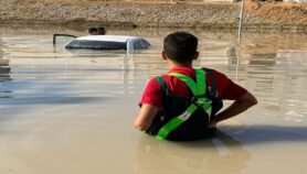
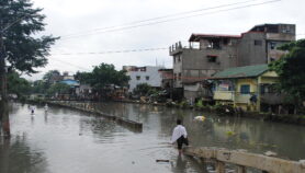
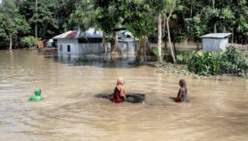
Floods, for example, could work quite well because there is a distinct time delay between water accumulating and it travelling downstream. NASA researchers are already working on an automated ‘Sensor Web’ service that combines Earth observation data with topographical and hydrological data and alerts disaster managers in Namibia of impending floods.
Remote sensing clearly has a lot to offer disaster management. Satellites’ unique ability to continuously monitor large areas and spot disasters as and when they happen gives them a crucial role in providing early warnings.
The biggest challenge so far has been translating the satellite data into timely, simple to use, and easy to understand information, and communicating this to people on the ground, who may be in remote rural settings.
But mobile phone technology meets the communication part of this challenge. AFIS is a working example of how combining sophisticated Earth observation data with everyday technology can revolutionise disaster management.
Philip Frost is a remote sensing specialist at CSIR-Meraka Institute in South Africa and is the AFIS project leader.
More on Disasters