By: Melissa Gómez
Send to a friend
The details you provide on this page will not be used to send unsolicited email, and will not be sold to a 3rd party. See privacy policy.
[CARTAGO, COSTA RICA] A network of earthquake sensors being installed across the Caribbean to prepare for natural hazards and help reduce disaster risks is scheduled to be fully operational by 2015.
All countries bordering the Caribbean Sea are at risk of earthquakes and tsunamis due to its active tectonic plates.
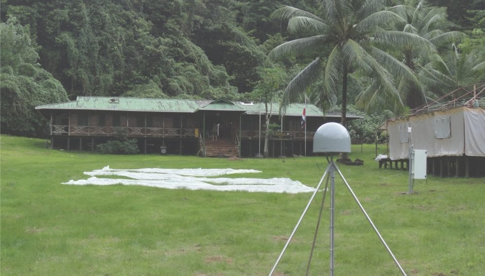
Work to establish a network of GPS (Global Positioning System) and meteorology stations for the region — called the Continuously Operating Caribbean GPS Observational Network (COCONet) — began in 2011. Initial results from measuring the direction and speed of plate movements, and identifying areas with strong seismic potential, have been promising, says Marino Protti, a geologist at the National University of Costa Rica, and a network member.
Protti says that all the information from the stations is transmitted in real time to UNAVCO, a non-profit, university-governed geoscience research consortium based in Colorado, United States.
UNAVCO analyses the data and provides technical advice on sensor installation and operation and data processing and interpretation.
COCONet is funded by the US National Science Foundation (NSF). This funding is due to finish in 2015 — when the network is scheduled to become operational — after which the plan is for money to come from research institutions in the region and, potentially, from the NSF if it decides to renew its funding.
“The key is working together to achieve a regional network that is greater than the sum of its parts.”
Glen Mattioli
The board responsible for NSF oversight recently approved UNAVCO's new cooperative agreement, which funds core activities such as its work with COCONet. The agreement means that UNAVCO will be funded from 2013 to 2018, although the NSF has yet to finalise the budget for this period.
As well as research, the network also aims to educate people in the region about the nature, frequency and potential impacts of natural hazards, and strengthen earth and atmospheric science research and education at regional institutions.
Glen Mattioli, the network's project manager, tells SciDev.Net that the network is launching two programmes to increase research capacity in the Caribbean.
The first of these will offer graduate research fellowships that will provide funding to graduate students from the Caribbean who are working towards advanced degrees at US higher education institutions on science related to the network's work.
Secondly, Mattioli says, the network will soon announce a call for proposals for one or more regional data centres to provide the region with some of the services that UNAVCO provides for the United States.
The network has also furthered regional cooperation through three workshops bringing together regional data providers and other stakeholders as well as scientists and students interested in using its data.
The region, including Central America, northern South America, the eastern Caribbean and the Greater Antilles, already has several institutions and organisations that have deployed sensors, and have significant capacity and technical expertise, and appropriate scientific leadership.
The key is working together to achieve a regional network that is greater than the sum of its parts, says Mattioli.


