Send to a friend
The details you provide on this page will not be used to send unsolicited email, and will not be sold to a 3rd party. See privacy policy.
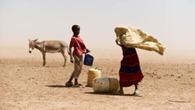
Aid organisations could be making better use of their data by using low-cost mapping technologies, according to CartONG, an NGO that develops the use of GIS (geographic information systems) for humanitarian and development programmes.
The France-based NGO, which was started in 2006 by a handful of volunteers, is now developing a technical blog to share advice on using GIS technologies in the aid sector. This includes the GPS (global positioning system) devices used to collect geospatial data as well as the software used to analyse it.
Sandra Sudhoff, CartONG’s technical director, says that few online resources specifically examine the use of these mapping tools in aid contexts.
“We often get new insights by reading other tech blogs, but then have to find ways to employ those tips for aid sectors. There are not many tech blogs linking both humanitarian and technical issues,” she says. “We spend considerable time figuring things out and want to assist others using similar tools so they can learn from our trial and error.”
“Collecting big data sets is necessary and easy for NGOs, but the capacity to analyse them remains a challenge.”
Sandra Sudhoff, CartONG
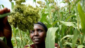
The NGO often relies on open source software such as QGIS — a program that maps out geospatial data — as well as more prosaic online tools such as OpenStreetMap and Google Earth. Its projects have ranged from making maps for emergency relief in Haiti to creating thematic atlases for Médecins Sans Frontières (MSF) to developing free e-learning kits for sustainable forest management.
CartONG is among a handful of NGOs working internationally in GIS capacity-building for the aid sector, according to Giacomo Rambaldi, senior ICT programme coordinator at the Technical Centre for Agriculture and Rural Cooperation, based in the Netherlands, and a specialist in community-based GIS.
Demand for such training is growing as the use of GIS in the aid sector has taken off over the past decade, explains Rambaldi, citing the decreasing costs of data-gathering devices and the accessibility of web-based applications as the main reasons.
“GPS technology and digital maps are now widely available. There has been a democratisation through the internet, and many people can now access and use the resources available online,” he says.
GIS demand is also being driven by increasingly stringent donor requirements for detailed data, says Sudhoff.
"Collecting big data sets is necessary and easy for NGOs, but the capacity to analyse them remains a challenge. There are very few organisations that actually use GIS analysis systematically.”
Maps are also valuable communication tools, adds Sudhoff, giving as an example CartONG’s work with the UNHCR, the UN’s refugee agency, to map the movements of internally displaced people in Uganda in 2007.
The maps were quite powerful, she says, and “were directly used to lobby district officials for movement rights and better security for the people”.
CartONG has also carried out GIS training with the UN Institute for Training and Research, the German Development Agency and the Swiss branch of MSF, among more than a dozen NGOs and aid agencies it has worked with.
But capacity-building with small NGOs lacking the deep pockets of international agencies has remained a challenge, says Sudhoff. Both a pilot project to map the prices of cashew nuts in Côte d’Ivoire to promote sustainable agriculture and a multimedia platform for a diabetes programme in Kenya failed to scale after funding from international partnering organisations ended.
Rambaldi says he has seen many GIS projects fall through once project funding comes to an end.
“The key to success is choosing technologies that can be sustainably managed beyond the project lifespan,” he says. “The beneficiaries should be provided with the tools and skills that will enable them to take control of the process.”
Given the relatively low cost of some of the technologies and software, NGOs in a wide range of sectors could benefit from implementing GIS analysis in their programming, according to Benoit Ravidat, an IT project manager at disability charity Handicap International, who participated in workshops with CartONG in 2010.
“Having basic training in GIS brings new possibilities with the understanding of how these technologies can support projects,” he says. “But the real benefits of GIS will be determined when a critical number of actors [in the aid sector] begin to share and develop new uses for the technologies.”
More on Aid