By: Mark Tadross
Send to a friend
The details you provide on this page will not be used to send unsolicited email, and will not be sold to a 3rd party. See privacy policy.
Combining statistical and physical models offers the best hope of predicting changes in local cyclone risks in the Indian Ocean, says Mark Tadross.
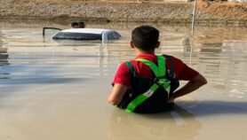
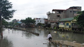
Tropical cyclones affect many people. They can kill, often cause widespread damage, and usually bring economic losses. This is particularly true in developing countries such as Madagascar, where on average cyclones affect 250,000 people per year and cause damage worth US$50 million. Given the expected rises in global temperature and shifts in the climate system, it is natural to question if cyclones and the risks associated with them will increase in the future.
Predicting how climate change will affect cyclones is difficult, partly because global climate models are rather crude and have difficulty representing cyclones in their early stages. Even so, there are relationships between large-scale climate features that are expected to change — such as the temperature of the ocean and atmosphere — and the expected frequency and intensity of cyclones.
Over the southwest Indian Ocean, these relationships suggest that by the turn of this century there will be fewer cyclones during early summer. But they also suggest cyclones may become more intense, with even stronger winds. This is consistent with studies around the world.
Unfortunately, such relationships between the large-scale climate and cyclones only hold true for extensive regions and cannot be used to accurately predict changes within regions or countries. Change at this level often depends on changes in likely cyclone tracks.
To get local-level accuracy, global models must be scaled down. This is done either by using regional versions of the global model (based on modelling the complex flow of heat, moisture and momentum between land, atmosphere and oceans) or statistical models that attempt to draw simpler direct mathematical relationships between, for example, surface temperature or wind and local climate (assuming that surface temperature or wind has a large effect on the local climate).
Regional modelling
Physical modelling has the advantage of resolving many of the climate’s physical components, such as winds, moisture and temperature, providing information on many different aspects of climate. But representing physical processes that take place at resolutions less than the model can directly resolve can lead to incorrect representations. For example, the way heat and moisture transfers between the ocean and atmosphere, or the energy balance calculated from the representation of rainfall and clouds, may be wrong.
Running regional versions of global models also needs extensive computing resources. To have confidence in the outputs, researchers would need to run regional simulations within many different global models, for both present and future climate scenarios. This is not a viable option for developing countries like Madagascar, which have limited computing infrastructure.
Using statistics instead
The other option is to combine statistical and physical models to simulate thousands of cyclone tracks and their associated winds. The Malagasy Meteorological Service take this approach, using data produced by researchers at the Massachusetts Institute of Technology, United States.
This lets researchers use robust statistics to assess likely changes in track positions and winds in future climate scenarios. And the fine spatial resolution means predictions can be made for local areas. But there is a problem. The predictions often differ depending on which physical model the statistics are combined with.
To be confident of their predictions, researchers must assess which are consistent between downscaled models. This remains a challenge — is it sufficient if four out of seven models agree on the change or do we need five or six models to agree?
Even so, given the uncertainties and costly computing associated with physical modelling, statistical approaches appear to offer the best hope for predicting regional and local change in the short-term.
Vulnerable populations
But this is still only half the puzzle. It is not enough to simply improve our modelling and understanding of cyclones. To assess the risks cyclones pose to real populations, we must also consider who is most vulnerable, which livelihoods will be hardest hit, and what infrastructure is most at risk (see ‘Vulnerability maps could help cut cyclone death tolls’).
Defining vulnerability at small spatial scales can be difficult, especially in developing countries where long-term data and statistics are often lacking. For instance, it may be necessary to estimate regional agricultural losses in cyclone-hit areas — yet frequently only national data are available. In Madagascar, when our teamattempted to assess which buildings were vulnerable to cyclones of varying strengths, the only readily available information was on damage to schools during cyclone Gafilo in 2004.
So even if we do manage to model cyclones at a fine spatial scale, the question will still remain: can we provide information on vulnerability with a similar precision? If not, then we will only be able to evaluate changes in risk for the largest regions, where both vulnerability and changes in cyclone characteristics can be accurately quantified.
Mark Tadross is a senior research fellow in the Department of Environmental and Geographical Science at the University of Cape Town, South Africa.
This article is part of a Spotlight on Tropical cyclones in the Indian Ocean.
More on Disasters