By: Alex Abutu
Send to a friend
The details you provide on this page will not be used to send unsolicited email, and will not be sold to a 3rd party. See privacy policy.
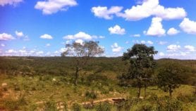
[CANCUN, MEXICO] A satellite imagery tool that will make an unprecedented amount of environmental data available freely online has been launched at the UN Climate Change Conference (COP 16), in Mexico.
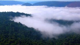
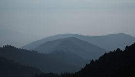
Earth Engine, launched by Google last week (3 December), aims to enable scientists to monitor and measure changes in the Earth’s environment, such as global land cover, and hopefully help slow deforestation in the process.
"Google Earth Engine takes advantage of Google’s large-scale ‘cloud’ computing infrastructure to build a powerful database out of the thousands of satellite photographs from the past 25 years, many of which have never been analysed," said Rebecca Moore, engineering manager on the project. "It will be available online for use by scientists, independent researchers and nations."
Google said at the conference that it plans to donate "ten million CPU-hours a year over the next two years on the Google Earth Engine platform, to strengthen the capacity of developing world nations to track the state of their forests."
Ademola Braimoh, a senior natural resources management specialist at the Agriculture and Rural Development Department at the World Bank, United States, said the tool "is a significant progress" and could be "indispensable for food security surveillance, water resources management, epidemiological modelling and diseases mapping, and monitoring of environmental disasters.
"In the past, scientists in developing countries faced serious difficulties in accessing satellite and other spatial data for mapping deforestation and monitoring land-use changes," he said. "The engine potentially fills these gaps."
But scientists at the conference have expressed doubts over the tool’s ability to deliver accurate data on forests and ecosystems in the developing world.
Giovanni Rum, forest and carbon tracking coordinator at the Geneva-based Group on Earth Observations, said that the engine is a useful tool — but many challenges remain.
"A lot of explanation is needed on issues of data certification and accuracy," he said. "The engine cannot operate on the basis of one-size-fits-all, the environmental situation in various countries is different and cannot be accurately analysed using satellite images alone."
And Marc Steininger, scientific director of Conservation International’s Habitat Monitoring, United States, said that the engine could facilitate data access in developing countries if scientists were trained to use the facility.
But Martin Tadoum, deputy executive secretary at the Conference of Ministers of Forestry of Central Africa, in Cameroon, said: "Satellite data without [gathering field data on the ground] will not give you an accurate picture nor help much in monitoring deforestation."
See below for a video about Google Earth Engine:
Or see how Google Earth Engine is being used by Surui people in the Amazon:
More on Earth science