By: Eva Aguilar
Send to a friend
The details you provide on this page will not be used to send unsolicited email, and will not be sold to a 3rd party. See privacy policy.
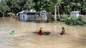
Disaster response and relief efforts are becoming more dynamic and decentralised with the development of web-based geospatial technologies, says a study.
Researchers writing in Disasters evaluated the experiences of Harvard University’s Center for Geographic Analysis (CGA) during the Sichuan and Haiti earthquake responses in 2008 and 2010, respectively.
They found that the conventional ‘top-down’ method of establishing emergency centres in damaged areas — usually managed by governments or relief agencies, to provide geographic data to decision-makers on the ground — has evolved into a more "dynamic" and "decentralised" disaster response due to the recent development of web-based geospatial technologies.
SPEED READ
- Web-mapping technology allowed a more decentralised response to Haiti’s 2010 earthquake
- Maps and images were added to the site to assist relief efforts
- Mobile phones and crowd-sourceed data may help create and access crucial data faster
Such techniques started to emerge as early as 2004, in the response to the earthquake that struck Chuetsu in Japan, they say.
But it was not until the Haiti disaster that the "much broader potential" of web-based geospatial information, such as maps and images produced by crowd-sourcing responders, was revealed as a tool to allow cooperation between those inside and outside affected areas, they add.
"The technology, and also the public awareness of it, matured at that point," Wendy Guan, one of the authors of the study, tells SciDev.Net.
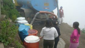
Immediately after the magnitude 7 earthquake that hit Haiti on 12 January 2010, the CGA created a website dedicated to the Caribbean country, following the experience of a first portal developed by the centre after the earthquake that occurred in Sichuan, China, in 2008.
The aim of the Haiti website was to collect geospatial data from different sources and make them available to governmental agencies, aid organisations and researchers.
"A lot of satellite imagery companies opened their archives and offered free images," says Guan. The most crucial information for rescue teams is that which allows them to know the situation both before and after the disaster, according to Guan.
CGA staff also printed a series of maps of the country’s capital based on a high-resolution satellite image taken the day after the earthquake. These provided a large-scale view of roads and buildings in Port-au-Prince after the disaster.
The maps were handed to a team of experts from Boston University, United States, who were travelling to Haiti for an emergency planning meeting with its government.
"I don’t think the website [was of much] use given the precarious condition of Internet connections in Haiti, but the maps were extremely useful," Enrique Silva, assistant professor of city planning and urban affairs at Boston University, and a member of the Boston team that travelled to Haiti, tells SciDev.Net.
"Port-au-Prince was paralysed and the people who had to make decisions didn’t have access to the affected neighbourhoods. The maps allowed them to see what they couldn’t see personally," he says.
The authors of the study recommend the creation of geospatial data sets in developing countries after disasters, not only to help emergency response efforts but also to help with long-term planning, including climate change adaptation and global warming mitigation.
"Every disaster is an open lab. From public health, to equity, to economics, to environmental protection, there are many subjects that you could study if you have access to the data on the ground," Guan says. "Also, not everybody has the luxury to travel there, and even if they do, they need information to guide their activity."
The peer-produced mapping provides a number of new avenues for producing and accessing spatial data, they say, for example, mobile phones could lead to "feeding real-time data to the web-based systems, and in turn accessing the web maps for latest updates".
References
Disasters doi: 10.1111/j.1467-7717.2012.01302.x (2012)
More on ICTs